
Written by Anne Scott
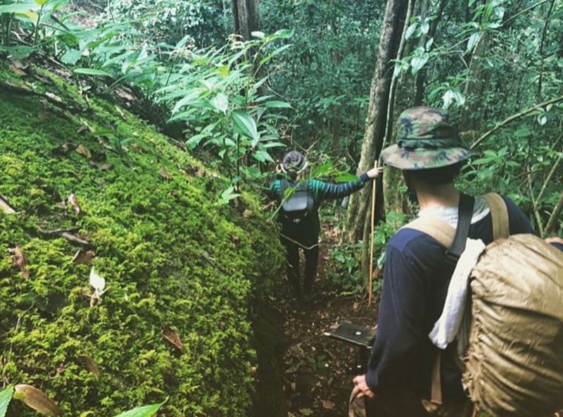
Whether you are in the north or the south of Thailand, the country holds thousands of fascinating hiking trails. Many of these take hikers up tall peaks, or through dense jungles to gorgeous viewpoints.
Also read: 19 out-of-this-world hiking trails in Indonesia with the most incredible views
To help you find your next adventure destination in Thailand, we’ve made a list of our 13 favorite hiking trails with incredible views. These scenic lookouts take you to sapphire blue waters, fascinating hill tribes, impossible green valleys and some of the highest peaks in the country.
So pack your hiking shoes and keep reading. We’re about to inspire your next adventure to the heavens.
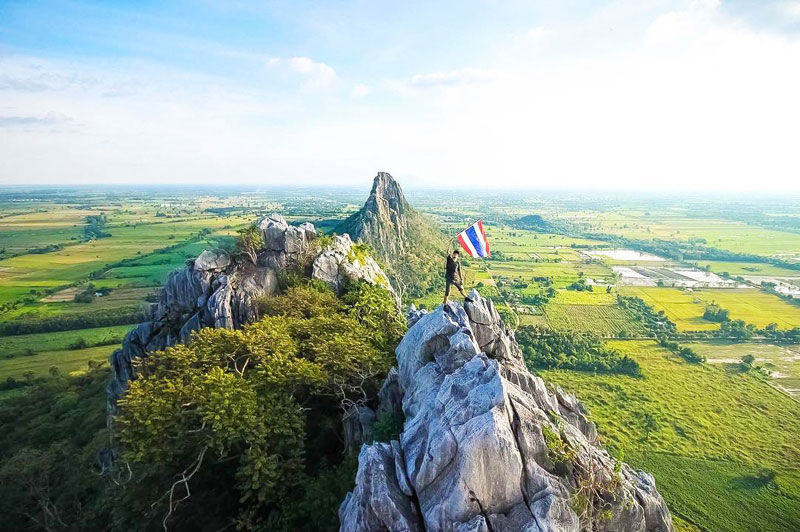
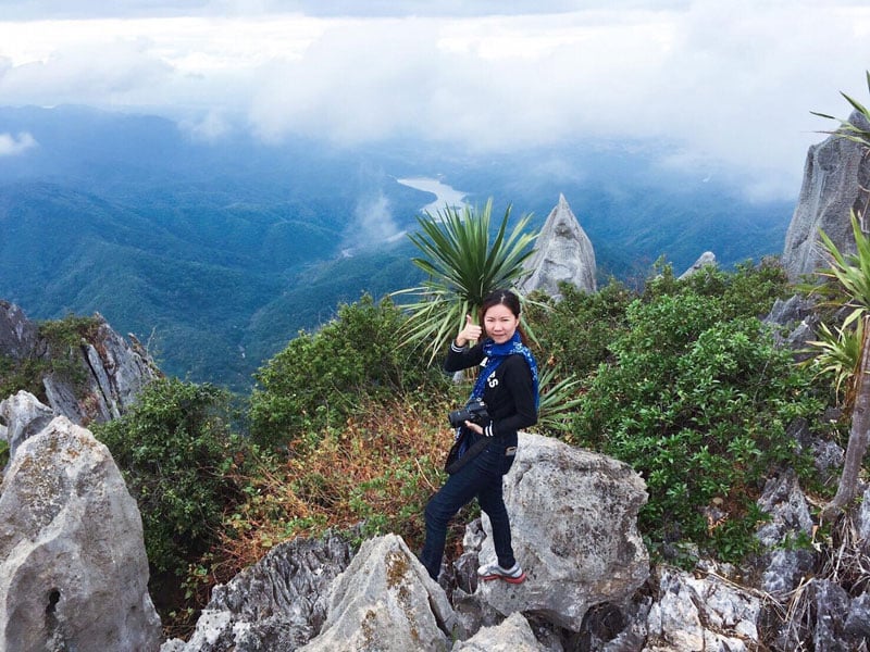
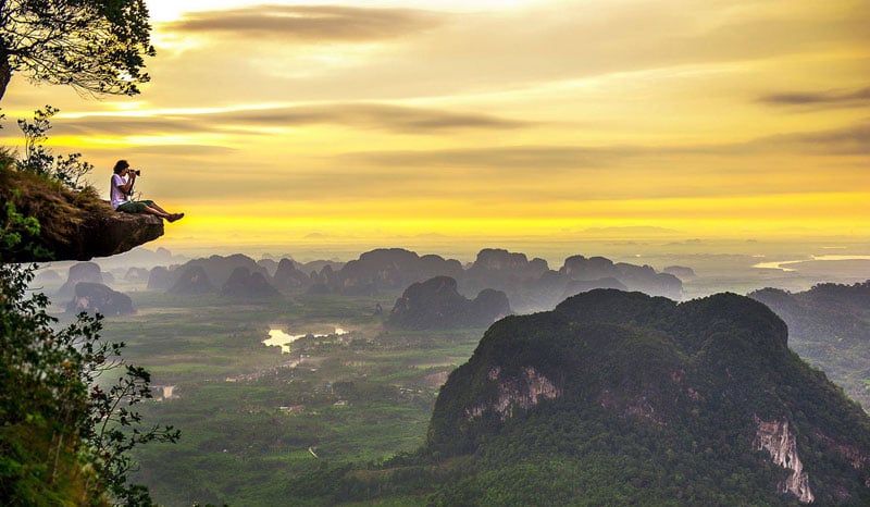
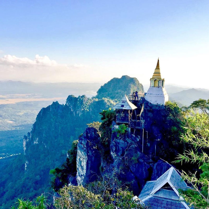
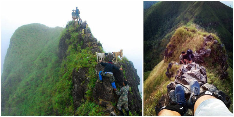
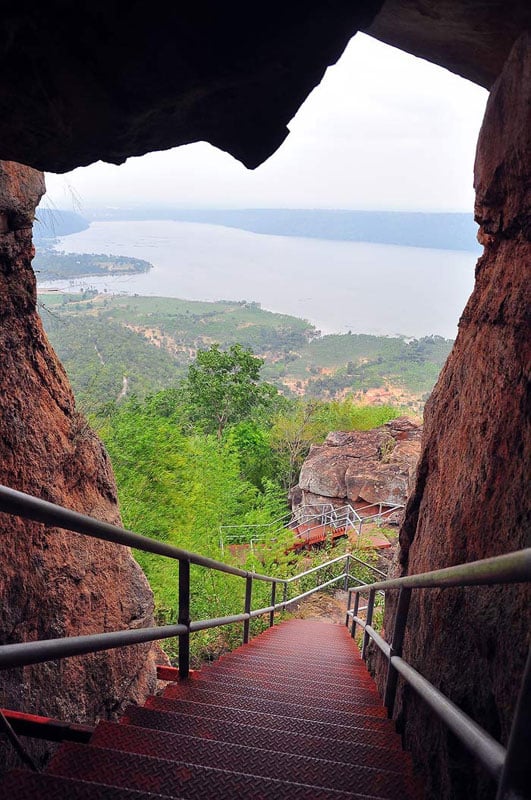
1. Easy and terrifying all at the same time, try this quick daredevil hike! – Khao No
You wouldn’t believe me if i said this was an easy yet terrifying climb.
We drove to Khao No and were welcomed by the hundreds, maybe thousands of monkeys at the foot of the limestone mountain. You’ll marvel at how cute the tiny baby monkeys are, and how trained they seem to be by the locals.
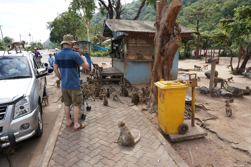
Before starting your climb, a fun activity is to buy a basket of chopped bananas from the locals, and feed the monkeys.
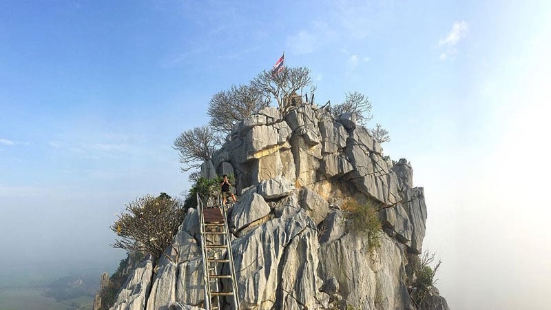
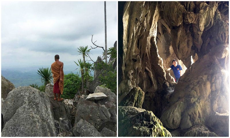
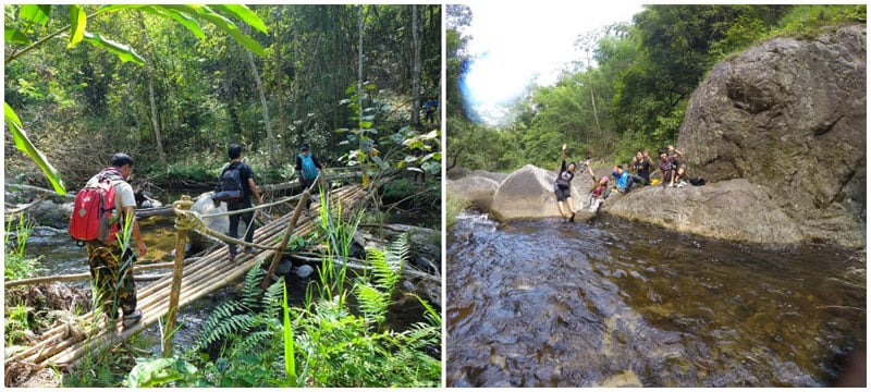
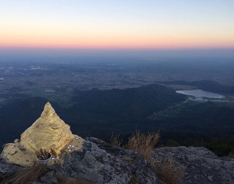
Finally, start your climb up the mountain. It’s a truly steep climb with rest stops along the way. There’s a stairway that leads to the cave at the peak where you’ll see a large seated Buddha. At night, you’ll also see bats swarming out of the cave in droves – quite the spectacular sight!
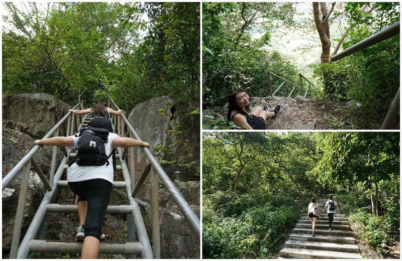
Personally, I was terrified of this climb due to how steep it was, especially when you look down. At the top, you’ll also find a steep metal ladder to climb right up to the top where wondrous sights await. This is only for those adrenaline junkies who love a good thrill, those with a fear of heights might want to skip out!
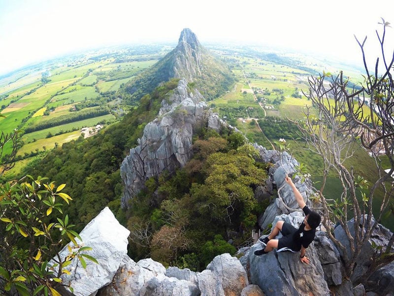
The terrifying steepness aside, this climb ranges from easy to moderately challenging, based on your level of fitness.
Khao No (เขาหน่อ นครสวรรค์)
Address: หมู่ 2, ตําบลบ้านแดน อําเภอบรรพตพิสัย จังหวัดนครสวรรค์, 60180 Tambon Ban Daen, Amphoe Banphot Phisai, Chang Wat Nakhon Sawan 60180, Thailand (Coordinates here – the hiking trail starts here)
Difficulty level: 6/10
Getting there: From Bangkok’s Don Mueang Airport, you’ll need to drive approximately 2h 40mins to reach Nakhon Sawan. From there, it’s another 40min drive to reach the start of the hiking trail. We recommend hiring a rental car (from USD $35 / approx. 1091 Baht per day) to get there.
Opening hours: Daily from 8am to 5pm
2. Get Ready to Defy Gravity – Doi Chang Cliffs (ดอยช้างผาด่าน)
Are you ready for a challenge? Then head to the little-known Doi Chang Cliffs. This hard-to-find trekking spot is ultimately rewarding.
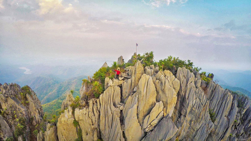
The trek begins with a challenging uphill motorbike ride. The roads here aren’t very well maintained so it’s best not to bring a car. Once you’ve found the parking space, the fun has just begun.
Walk uphill until you reach the temple on the side of the mountain. If you’re lucky, the monks that live here will come out for a chat. They may also offer to show you to a nearby cave for some awesome photographic opportunities.
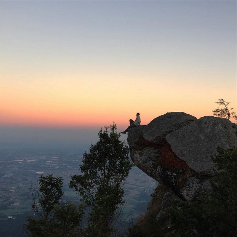
Then comes the really challenging part. You’ll need to scale the nearby cliffs. Be sure to keep your body as close as possible to the formations as you make your way up. In good weather, you’ll be able to see for miles around. There is very little vegetation on the top of these moon-like cliffs.
Say hello to the Thai flag and then make your way back to your motorbike. Do note that this trek takes all day, so packing lunch is a good idea.
Doi Chang Cliffs (ดอยช้างผาด่าน)
Address: Tambon Suan Khuean, Amphoe Mueang Phrae, Chang Wat Phrae 54000, Thailand
Difficulty Level: 8/10
Getting there: The Doi Chang Cliffs are located in Muang District of Phrae Province. To reach the trek, it’s best to hire a local guide if you are unfamiliar with the area. Otherwise, point your motorbike in the direction of the coordinates to find the starting point. (Coordinates: 18.110974, 100.297984)
Entrance fees: Free
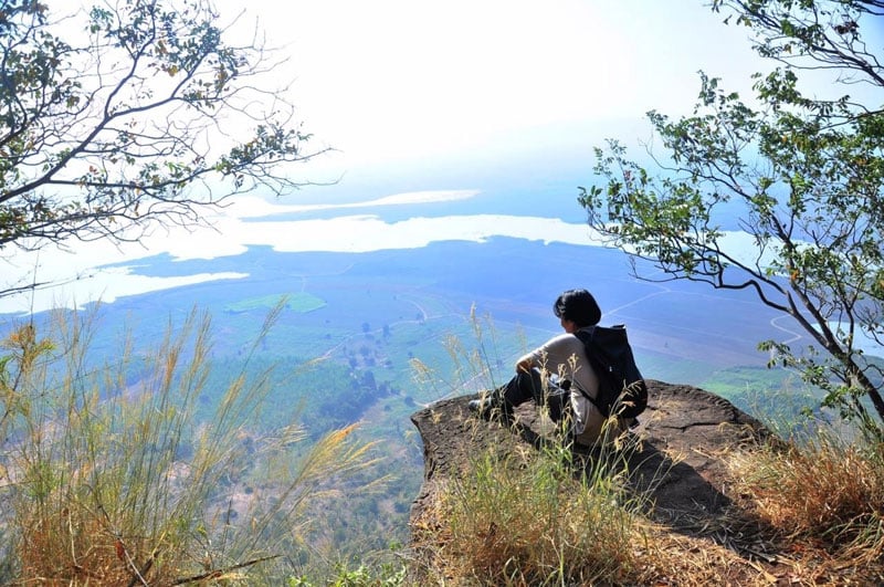
3. The Most Amazing Instagram Spot – Hang Nak Mountain Nature Trail
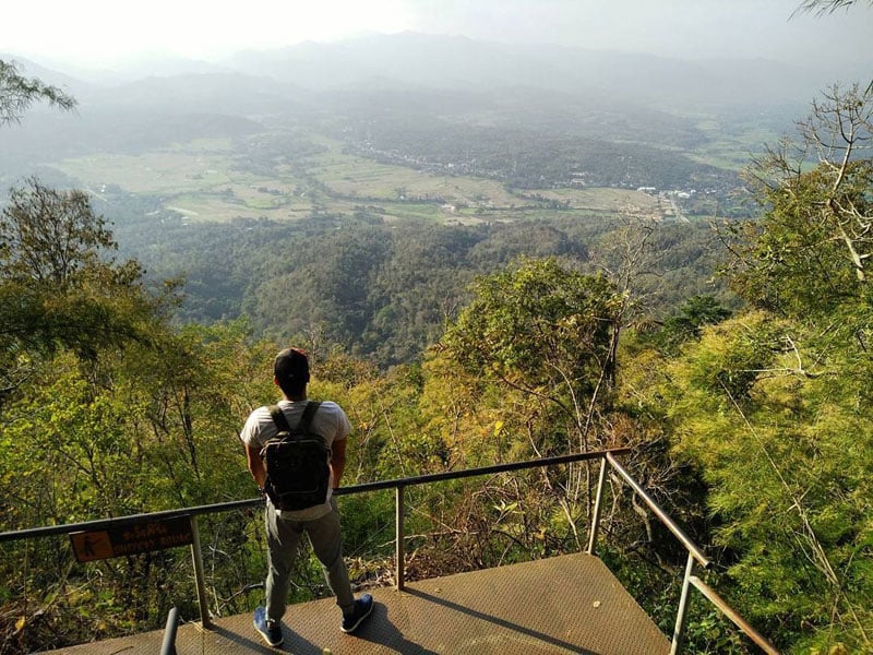
If you ever find yourself in the Ao Nang area with a few hours to spare, the Hang Nak Nature Trail is not to be missed. With a 4-hour round trip and a well-marked trail, you’ll enjoy stunning views across much of the Ao Nang and Krabi area as a reward for your commitment.
With a summit that sits around 500 meters above sea level, the 3.7km hike involves a steep ascent during the middle part of the hike but overall, a slow and steady approach combined with 2 litres of water per person makes this hike achievable for almost everyone.
The first part of the trail starts just beyond the parking area and follows alongside a mountain stream. As you begin, there is a clearly marked map which shows an optional hike to a nearby waterfall at around 2.8km (but we think this probably isn’t worth your time).
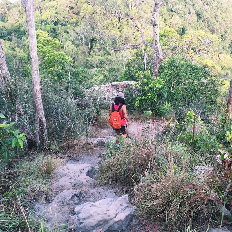
While following the clearly visible trail, you’ll get to see a few view points along the way. These are sure to encourage you and allow you to see the progress you have made.
Best walked in the early morning hours before the midday heat, the Hang Nak Mountain Nature Trail’s high point offers a clear view of the surrounding coastal areas and is definitely worth the effort.
Hang Nak Mountain Nature Trail
Address: Nong Thale, Mueang Krabi District, Krabi 81000, Thailand
Difficulty Level: 6/10
Getting there: The nearest airport is Krabi International. From there you can hire a taxi which will take around 50 minutes. If you are staying near Ao Nang, the journey is around half an hour. To get there on your own motorbike, take the coastal 6042 to its completion on the west coast where you will find the parking area. (Coordinates: 8.099169, 98.748394)
Entrance fees: Free
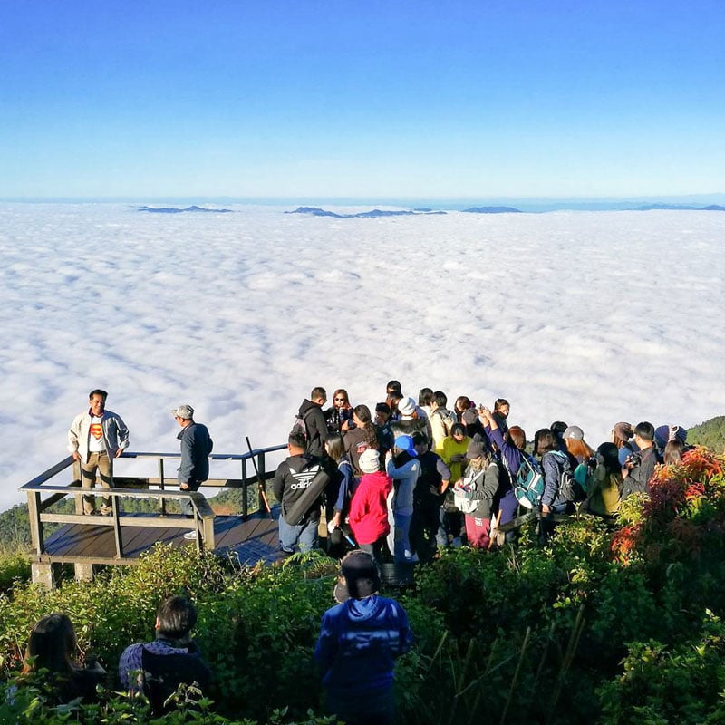
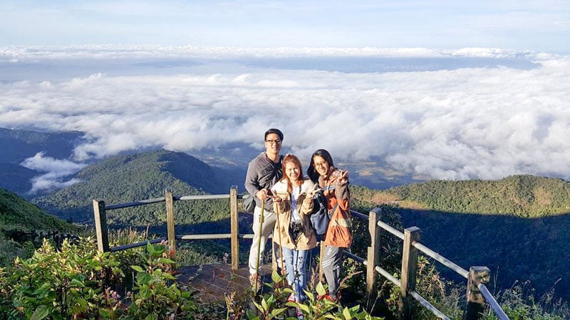
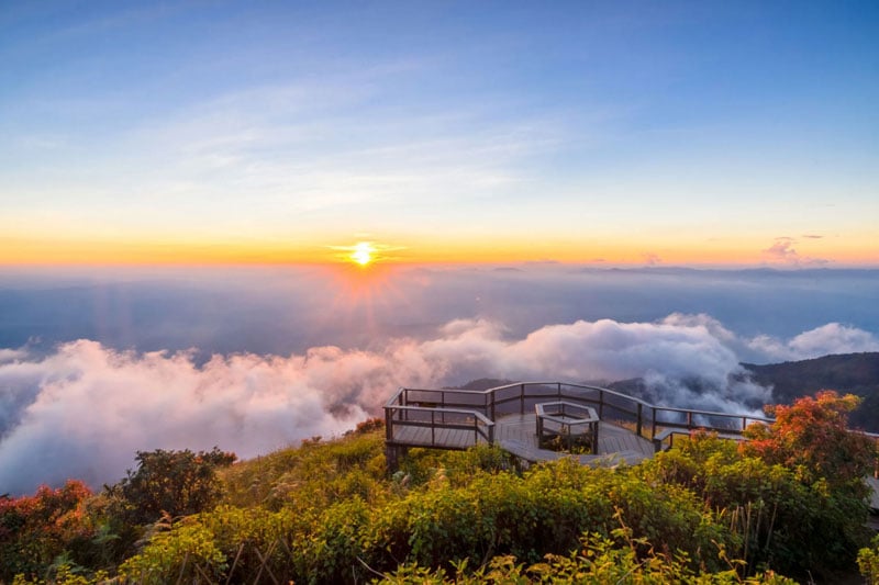
4. Trekking to see nature wonders and the mist – Kew Mae Pan, Chiang Mai (กิ่วแม่ปาน จังหวัดเชียงใหม่)
If you are a nature lover, you will love visiting Kew Mae Pan. Located in Doi Inthanon National Park, it’s also known as The Roof of Thailand.
Kew Mae Pan reaches high at 2,200m above sea level, just a few hundred meters shy from the highest peak of Thailand.
Get your comfortable shoes on and be prepared to walk. The path to get to the viewpoint is part of circular 2.7km nature trail. But don’t worry, it’s quite an easy trek (with some stairs). Plus there are a lot of Instagram worthy along the way to keep your camera busy for 2-3 hours.
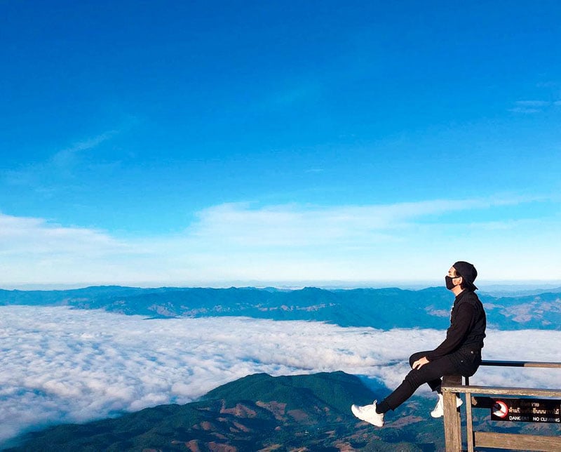
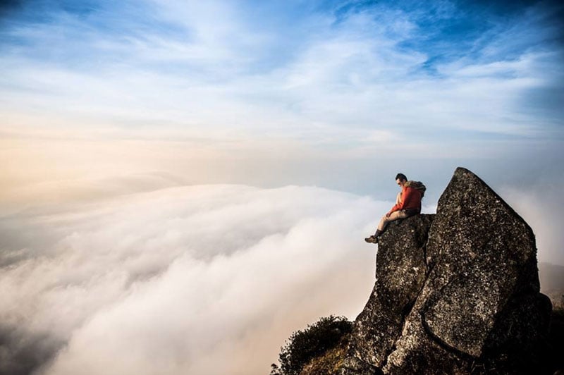
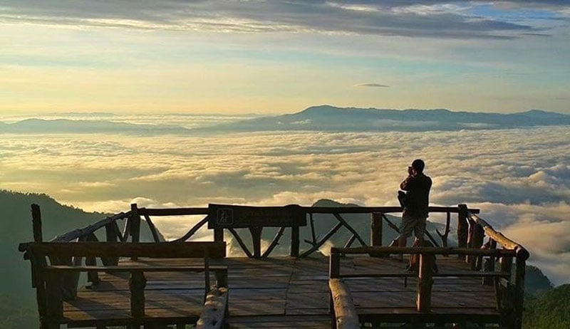
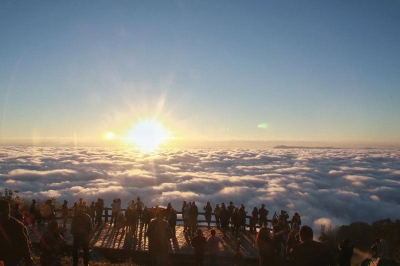
You’ll reach the viewpoint halfway through the trail. After you pass the thick forest and waterfalls – you’ll come to the open grassland with spectacular panoramic views of the mountain and the sea of clouds as far as your eyes can see.

Here comes the fun part during the second half of the trek, you will walk along a narrow path on the ridge of the mountain – thrilling! The path is only 1 meter wide, so everyone must walk in a single file and be extremely careful.
If you visit in December, you will see red azalea (Thais call it ,“Thousand Years Red Rose”) in bloom along the cliff too.
After you finish the trek, don’t forget to stop at The Great Holy Relics Pagoda Nabhapolbhumisiri to see two beautiful pagodas on top of the summit.
Kew Mae Pan, Chiang Mai (กิ่วแม่ปาน จังหวัดเชียงใหม่)
Address: Ban Luang, Chom Thong District, Chang Wat Chiang Mai 50160, Thailand (Coordinates here)
Difficulty Level: 5/10
Getting there: Fly to Chiang Mai International Airport and rent a car. Take the 2 hour drive to the West (towards Doi Inthanon National Park). From the airport, follow ถนนเลี่ยงเมืองสันป่าตองหางดง, Route 108 and Route 1009 to ซอย 1009 in ตำบล บ้านหลวง for almost 2 hrs and continue onto ซอย 1009. Destination will be 4 mins away on the left.
Contact: 053 286 729 (Visitor Center)
Opening hours: Daily from 6am to 4pm
Entrance fee: You’ll have to pay to enter Doi Inthanon National Park. USD $8.50 / 300 Baht (for foreigners), USD $4.20 / 150 Baht (for children); USD $1.40/50 Baht (for locals), USD $0.60/20 Baht (for local children). For the Nature Trail, you will require local guide which will cost USD $7 / 200 Baht for a group of 10.
Best time to visit: The National Park opens from November to May (closed during rainy season). The Nature Trail opens from 6am to 4pm. The best time to see the sea of clouds is from November to February.
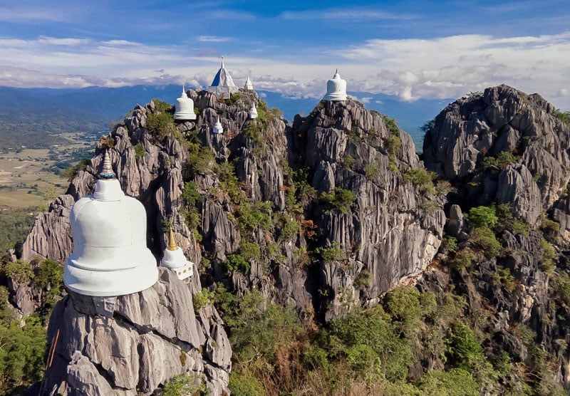
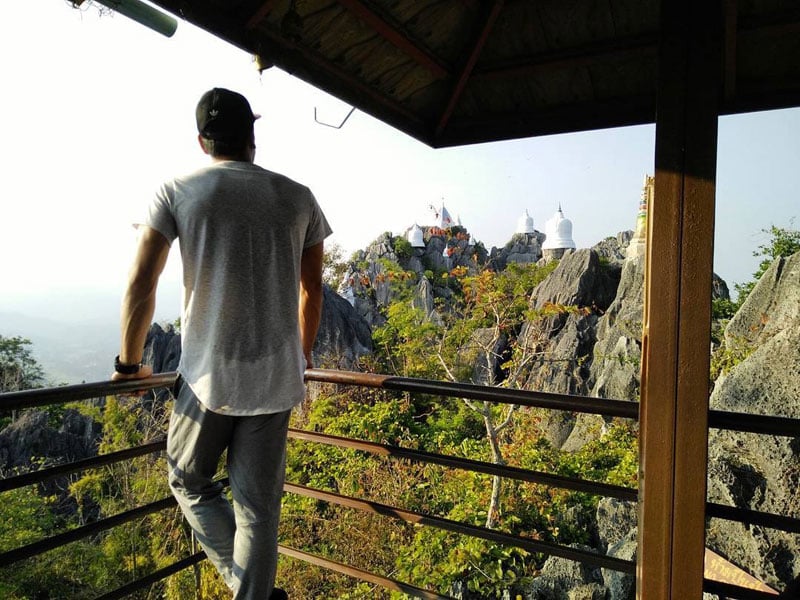
5. Unprecedented location and the most breathtaking temples and pagodas in all of Thailand – Wat Chaloem Phra Kiat Phrachomklao Rachanusorn, Lampang (2.5 hours from Chiang Mai)
Also known by the names Wat Phabatpuphadang, Wat Phrabuddhabat or Wat Doi, these spectacular temples and pagodas are truly one of a kind. Clinging to the jagged cliff face at the top of a mountain, the temples overlook a sheer drop close to 1,000 meters below!
An hour’s drive from Lampang deposits you at the first level, where you can wander around the main temple, and meet the monks who live in this area.
The second level is farther up the mountain, and can be accessed by tuk-tuk or on foot. Here you will find the famous footsteps that are believed to belong to Buddha.
Leading to the final level of the temple complex are 800 extremely steep steps that bring you to the most magnificent mountain top in Thailand. This third tier is known as Doi Prat Bet – and here you’ll find the golden pagoda, prayer hall, and many white stupas scattered along the rocky surface of the mountain top.
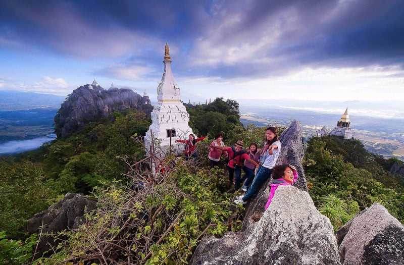
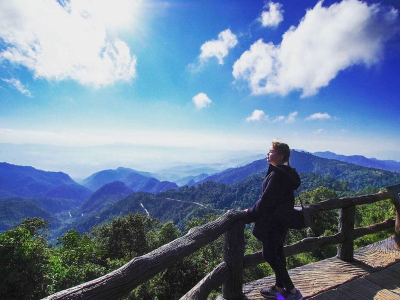
The 360 degree views from the summit are incredible; the Thung valley below, the hills in the distance, and the temples surrounding you. Located in the Lampang province (112km from Chiang Mai), this magnificent, 3-level Buddhist tribute may be a little difficult to get to, but more than worth the journey.
Wat Chaloem Phra Kiat Phrachomklao Rachanusorn (2.5 hours from Chiang Mai)
Price/entrance fees: Entrance to the first level is free. It will cost USD $2.80 / approx. 100 Baht for a round trip tuk-tuk ride from the first to the second level. There is no transportation provided between the second and third level; you will need to climb on your own.
Address: Mueang Pan, Mueang Pan District, Lampang 52240, Thailand
Difficulty Level: 4/10
Getting there: It’s a 3-hour drive from Chiang Mai. Otherwise, the easiest option is to take a domestic flight to Lampang Airport and then take a local bus or shuttle into Chaehom. From here you will need to hire a tuk-tuk or taxi to take you to the temple’s ground level. Coordinate here
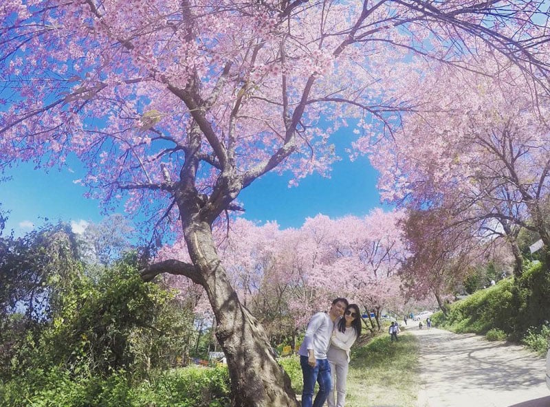
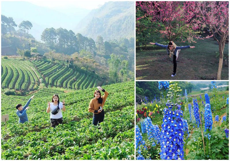
6. Easy Mountain Views – Phu Thap Boek Mountain (ภูทับเบิก)
If you’re looking for an easy hike with stunning views, look no further than Phu Thap Boek Mountain. Sometimes referred to as Phu Thap Boek, this destination is located in Phetchabun Province and is reachable by car. However, the mountain roads can be challenging, so it’s best to come with a 4-wheel drive or a private, local driver.
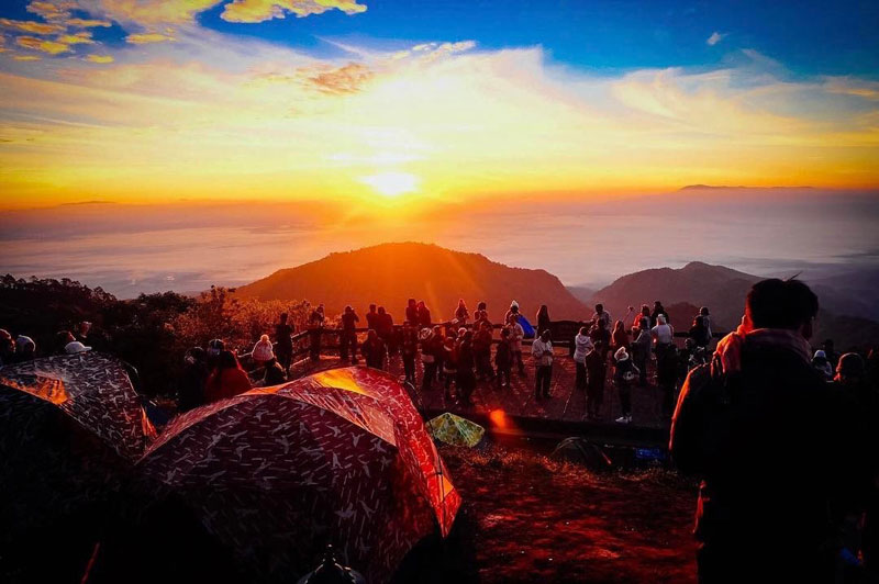
This mountain is particularly famous for its stunning views. Most mornings feature a blanket of cloud laid out under the mountain, and during the rainy season, mist engulfs the area 24 hours a day.
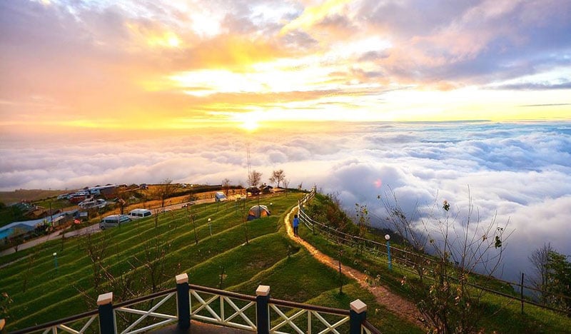
Perhaps the most wonderful time to visit is the cool season from December to January. At this time, the hills are covered by cherry blossom trees.
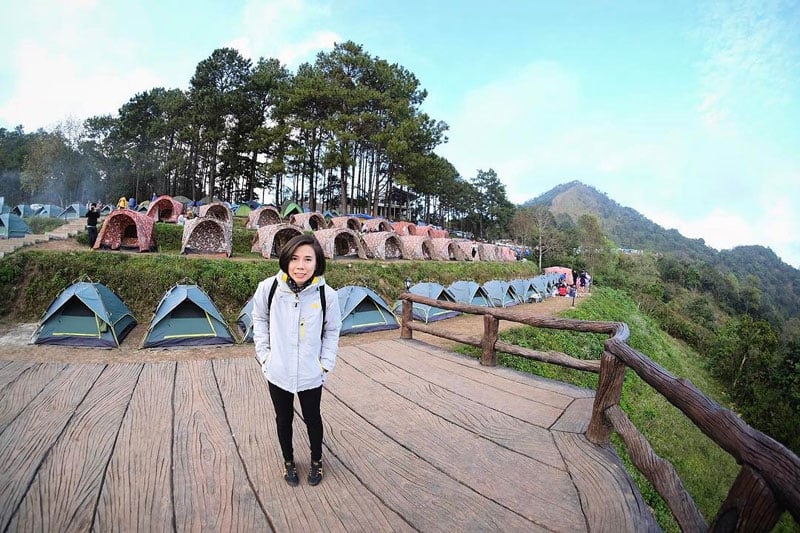
Previously undeveloped, Phu Thap Boek Mountain has recently seen an explosion in accommodation driven by the Hmong Tribe. If you wish to stay overnight in order to see the bright, starry sky and the spectacular sunrise, you can find all sorts of options – from tents to rent all the way up to luxury resorts.
With an easily accessible viewpoint and plenty of accommodation, Phu Thap Boek Mountain may have the most worthwhile view in Phetchabun Province.
Phu Thap Boek Mountain (ภูทับเบิก)
Address: Mu 14, Wang Ban, Lom Kao, Phetchaboon 67120 Thailand
Contact: +6656709026
Difficulty Level: 1/10
Getting there: Take the bus to Lom Kao Station then hire a minivan or taxi to take you to the top of Phu Thap Boek Mountain. The drive should take between 45 minutes and 2 hours depending on the road and weather conditions. (Coordinates: 16.906451, 101.087233)
Entrance fees: Free
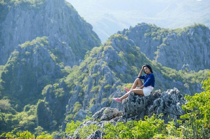
7. Up the Sharp Mountain – Khao Chang Phueak, Pha Phum National Park (เขาช้างเผือก)
Ranked third on Thailand’s list of tallest mountain peaks, Khao Chang Phueak is a moderately challenging peak with a few tougher spots. The mountain’s nickname loosely translates as “sharp mountain ridge”, which is born from the terminal, tougher part of the hike.
This section leads you along the spine of the mountain ridge where you are rewarded with stunning views and eventually the mountain’s summit.
There is a limit to the number of hikers allowed to climb in one day (60 climbers). So it is important to contact and reserve your place before attempting the climb. This is due to the limited camping space and narrow hiking trails.
Your ascent up the mountain begins from just behind Etong Village. The nearly 8-kilometer hike will take the average hiker about 4 to 5 hours, after which you will arrive at the camping area.
Beyond this point, you will find a further trail that takes you to the very peak of the mountain. Some climbers choose not to ascend this part due to its narrow trail and steep ascent in many places.
The reward of unforgettable panoramas is certainly worth the pain for this Thai bucket list hike.
Khao Chang Phueak, Pha Phum National Park
Address: Pilok, Thong Pha Phum District, Kanchanaburi 71180, Thailand
Contact: +66 81 382 0359
Difficulty Level: 7/10
Getting there: The starting point for the hike is behind Etong Village, inside Pha Phum National Park. Journey time by car from Bangkok is about 5-6 hours. (Coordinates: 14.726976, 98.388600)
Entrance fees: USD $5.80 / approx. 200 Baht (for foreigners)
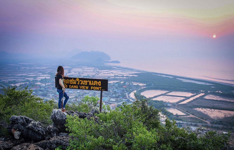
Website 8. Devastatingly Beautiful Panoramas – Khao Daeng Viewpoint (เขาแดง)
Offering breathtaking views of the coastal region surrounding Sam Roi Yot, the Khao Daeng Viewpoint is a rewarding trek that should take most capable hikers just short of an hour to summit.
Khao Daeng, which translates as the “Red Mountain”, is a short journey from the national park’s main headquarters.
From the main road, the trailhead can be found at the end of a sandy turnoff, which sits about 400 meters away from the headquarters. As you begin ascending, you will quickly find that the way up to the 157-meter high viewpoint can be quite tough in places, especially if there has been any rain recently.

For those in reasonable shape, this hike should take around 45 minutes. Make sure to take plenty of water, and it is best not to go alone as the trail is not clearly marked all of the way to the summit. Also, be sure to check that you have actually reached the highest point, as there are a few signs that may be confusing.
Once you have reached the top, you’ll be able to take in the stunning 360 degree views of the surrounding areas. You’ll find yourself lost in the mixture of beautiful limestone mountains, numerous shrimp farms and the seemingly endless view out over of the Gulf.
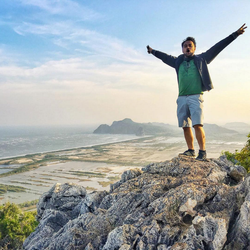
For those who want to make the experience just a little bit more memorable, get up extra early and summit for the stunning sunrise over the sea and mountains.
Also read: 24 out-of-the-ordinary things to do in Hua Hin and Petchaburi region
Khao Daeng Viewpoint
Address: Khao Sam Roi Yot National Park, Tambon Khao Daeng, Amphoe Kui Buri, Chang Wat Prachuap Khiri Khan 77150, Thailand
Contact: +66 99 230 5254
Difficulty Level: 5/10
Getting there: The best ways to reach Khao Sam Roi Yot National Park are by taxi or scooter. You can hire a taxi either in Bangkok or Hua Hin for a day trip. Alternatively, rent a scooter or car and take Route 4 to Pran Buri. Then turn left on Route 3168 and drive 5km. From there, turn left on Route 1020 and drive another 32km to the park entrance. (Coordinates: 12.132238, 99.958617)
Entrance fees: USD $5.80 / approx. 200 Baht (for foreigners)
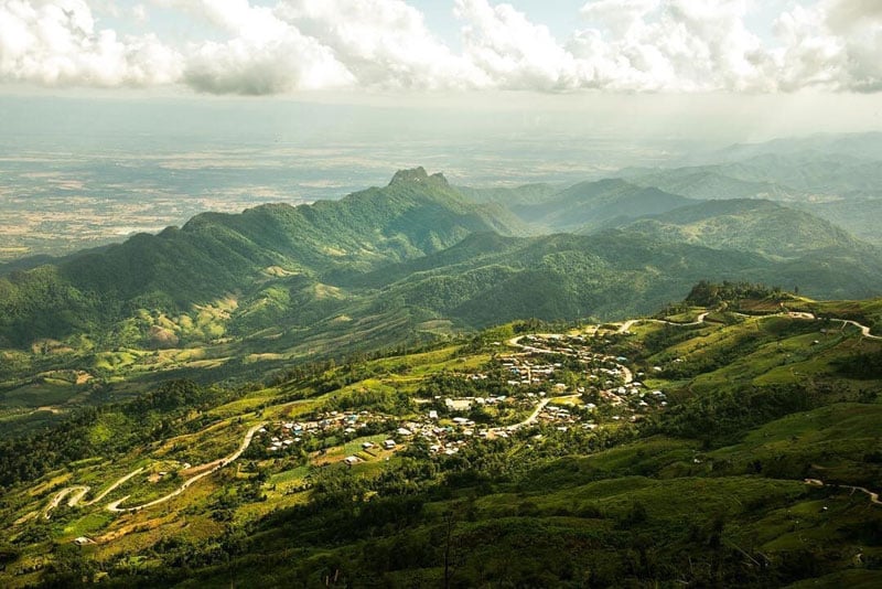
9. Up the Long and Winding Road – Doi Pha Tang (ดอยผาตั้ง)
Only about 25 kilometers north of number 12 on our list, Doi Pha Tang is a less popular mountain destination on the Laotian border. The English translation of its name means “mountain cliff vertical” if that gives you any indication what Doi Pha Tang is all about.
The main place to stay in the area is the village that’s also called Doi Pha Tang.
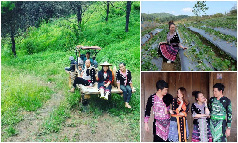
Here you’ll see gorgeous cherry blossoms and fields of green cascading down the mountain. Chinese Haw, Hmong and Yao tribes all inhabit the area. Once you reach this village, you’ll have several options for your hike.
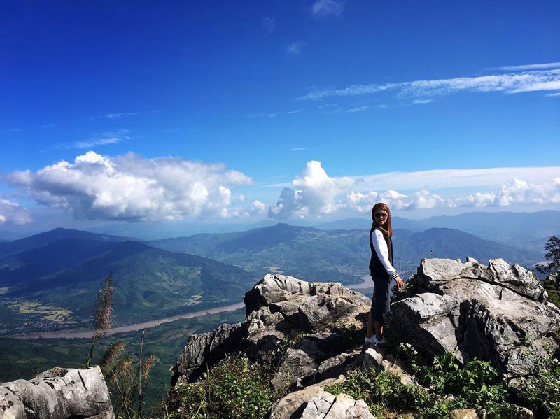
Popular viewpoints include Pha Bong Door, the Chinese Pavilion, Chong Pra Krad and Sea Mist 102. However, the most beautiful of the viewpoints is Sea Mist 103, which offers excellent panoramas and misty morning sunrises.
Local maps will tell you where each viewpoint lies, and all involve an easy walk along the mountain ridge. To see all the viewpoints, you will need approximately 4 hours.
Doi Pha Tang
Address: Po Subdistrict, Wiang Kaen 57310, Thailand
Difficulty Level: 3/10
Getting there: From Chiang Rai take Route 120 to the Mae Korn intersection. Turn left onto Route 121. In Thoeng, turn left onto Route 1155. After 25 kilometers, turn onto Route 1093. The entrance to Doi Pha Tang will appear after another 25 kilometers. (Coordinates: 19.931118, 100.519395)
Entrance fees: Free
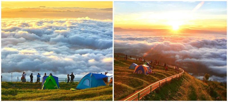
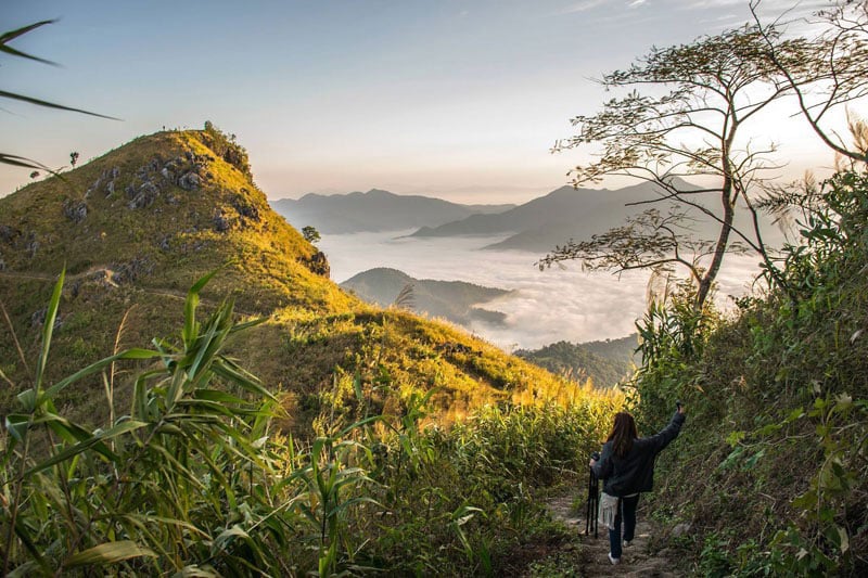
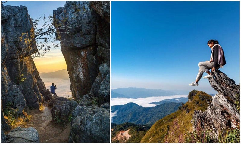
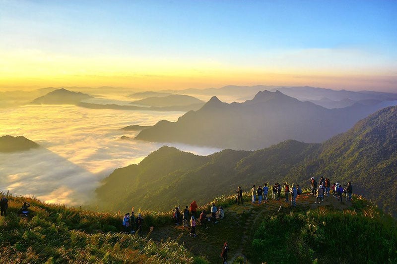
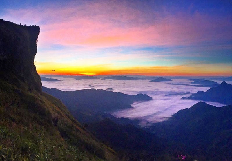
10. Among a Sea of Mist – Phu Chi Fa (ภูชี้ฟ้า)
Near the Laotian border and just a few hours from Chiang Rai lies Phu Chi (Chee) Fa, a mystical mountain with an easy hike to the top.
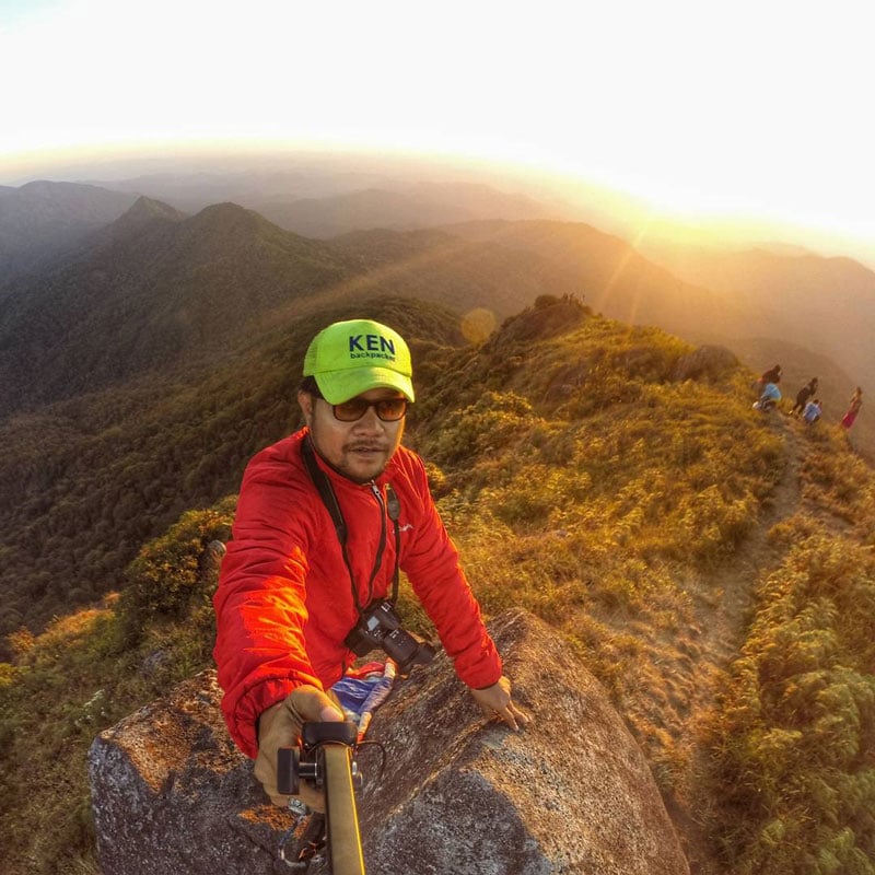
The best time of day to see Phu Chi Fa is at sunrise. A soft, yellow sun slowly rises over the distant horizon, announced by shades of pink, blue and orange. It’s a magical time.
Luckily, the Thai people have long realized this and have developed the nearby area to accommodate tourism. The town hosts several resorts that are usually filled with those anxiously awaiting the next morning.
Your best bet is to arrive here the evening before, stay the night while enjoying cool weather and even a few strawberries, then take a songthaew to the start of the hike in the wee hours of the morning.
From the parking area, it’s about a 35 to 45 minute hike to the top. The walk is quite accessible and everyone from children to seniors should be able to complete it. Once at the summit, sit back and watch the rainbow of colors that will shortly appear on the horizon.
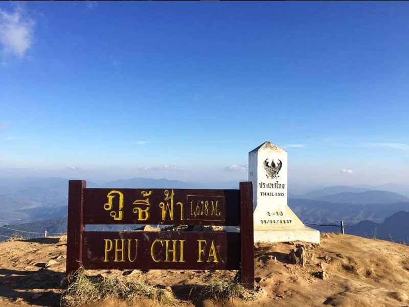
Do note that the winter months offer the best visibility for the sunrise, but do pack warm clothing. Phu Chi Fa is quite high and therefore quite cold even in the warmest seasons.
Phu Chi Fa
Address: 57310 Tambon Tap Tao, Amphoe Thoeng, Chang Wat Chiang Rai 57310, Thailand
Contact: +66 53 795 345
Difficulty Level: 3/10
Getting there: To get to Phu Chi Fa, you’ll either need to hire a private driver from Chiang Rai or take one of the public buses. Alternatively, you can drive yourself. The town and base camp sit on Route 1093. From town, it’s a dark songthaew ride to the start of the hike. (Coordinates: 19.850596, 100.453224)
Entrance fees: Free
11. Climb Alongside the Monks – Wat Khao Chom Thong (วัดเขาจอมทอง)
Come to Wat Khao Chom Thong for a workout or the view, either way you’re in for a treat.
Located about 3 and a half hours northeast of Bangkok, this monastery sits atop a high hill next to a dam. The viewpoint offers scenes across the surrounding water and villages.
To get to the top, you’ll first need to walk up a small road then climb more than 600 steps. Many of these are quite steep making this hike a quick but challenging one. However, the view of lush, jungle greenery on the way up makes time pass rather quickly.
Even before reaching your destination, you’ll be able to look out over the dam’s reservoir, seeing the tiny boats and water houses below.
At the top, you’ll find a small temple to explore as well as several sitting areas, which are ideal for a short meditation.
Whether you intend to photograph the sunset, worship at the temple or simply sit in the peace and quiet for a time – Wat Khao Chom Thong is an off-the-beaten-path attraction worth your time.
Wat Khao Chom Thong (วัดเขาจอมทอง)
Address: Khon Buri Tai, Khon Buri District, Nakhon Ratchasima 30250, Thailand
Difficulty Level: 5/10
Getting there: Coordinates: 14.459173, 102.104051
Entrance fees: Free
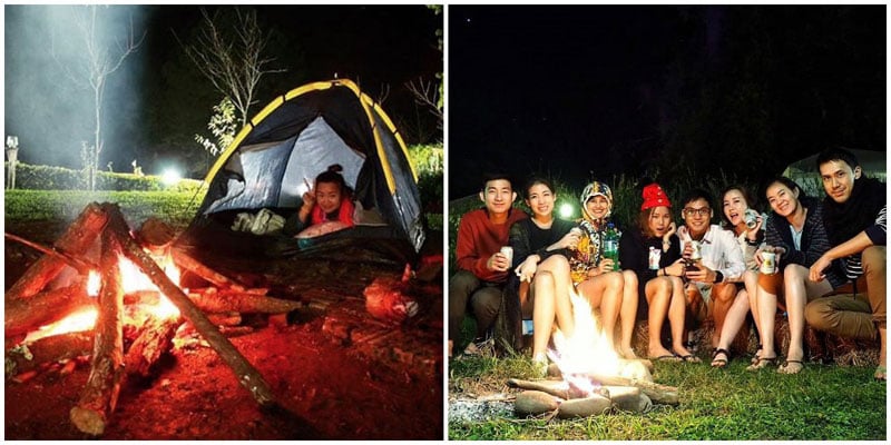
12. Camp on the Moon – Doi Pha Phueng (ดอยผาผึ้ง บ้านมณีพฤกษ์ อ.ทุ่งช้าง จ.น่าน)
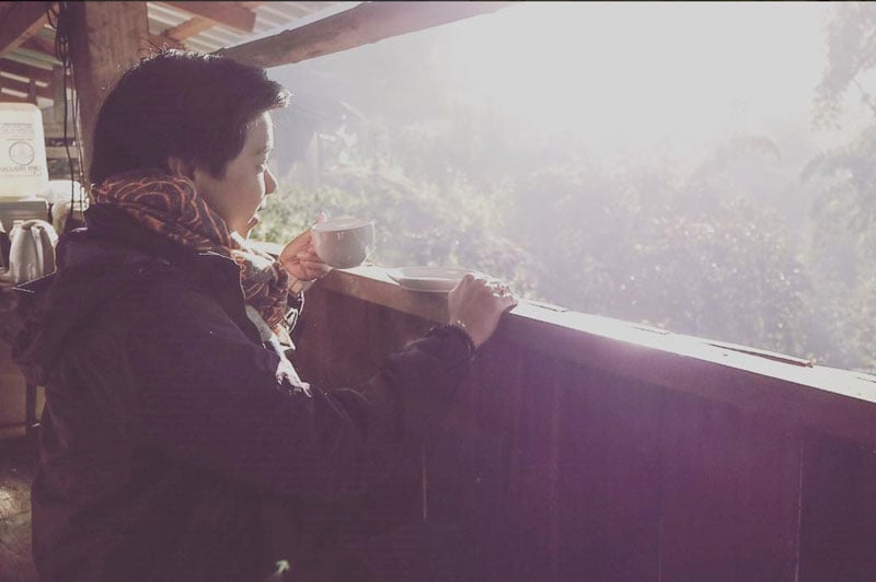
In the northeast section of Thailand lies Nan, a region full of interesting people and dramatic scenery. One of the best hikes in this area is Doi Pha Phueng, where you can enjoy a moonlike landscape, interactions with the Hmong Tribe and delicious, locally sourced coffee.
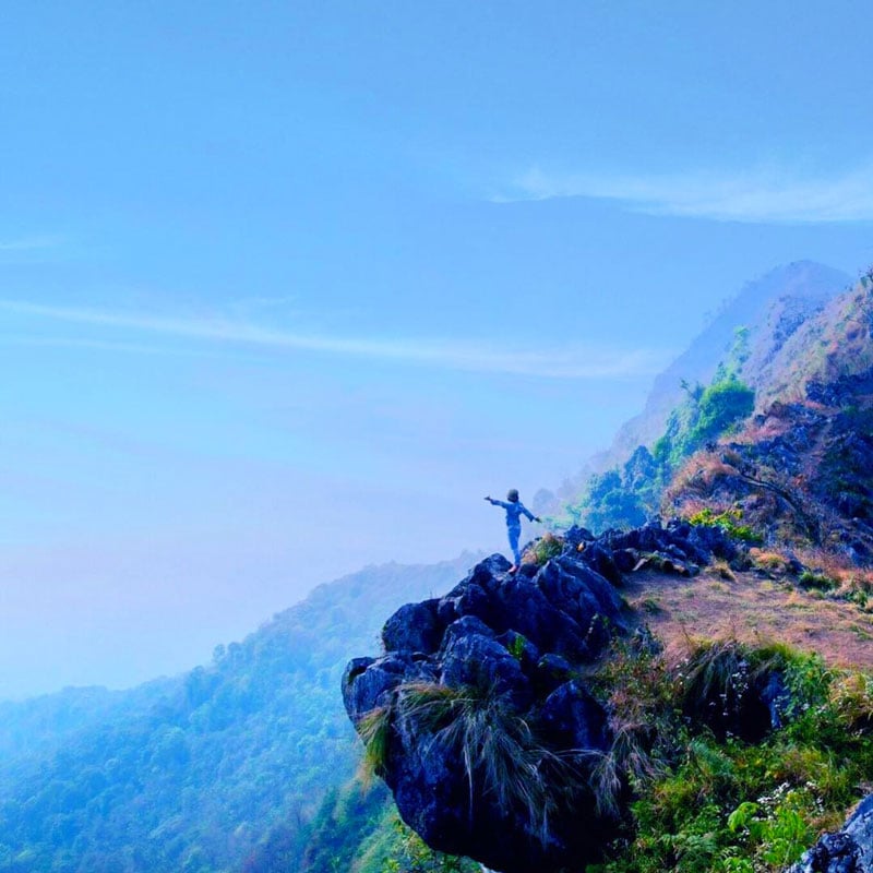
Doi Pha Phueng is a limestone mountain that sits 1,600 meters above sea level. The hike to the top of the mountain is only 20 minutes from the parking lot through plentiful fields. There’s not a tree in sight.
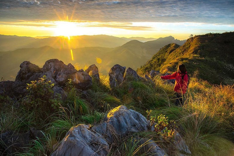
The best way to enjoy Doi Pha Phueng is by camping. Hike to the top in the late afternoon and set up your tent. Then watch the sun sink below the surrounding hills before enjoying a nice campfire and perhaps a beer or two. Don’t drink too much, though. You’ll want to be awake nice and early – in time to see the gorgeous sunrise.
If you happen to be in Thailand during the winter, be sure to schedule a trip to Doi Pha Phueng for the Hmong New Year. This tradition commences at the beginning of the first lunar month and if full of sporting events, parties and intricate clothing. It’s said that the Lunar New Year is a time for the single ladies of the village to choose their future husbands.
Doi Pha Phueng (ดอยผาผึ้ง บ้านมณีพฤกษ์ อ.ทุ่งช้าง จ.น่าน)
Address: Mani Phruek 3 Village, Nan, Thailand
Contact: +66 8 1602 2731
Difficulty Level: 2/10
Getting there: From anywhere in Nan Province, take Highway 101. Then turn right onto Highway 1291 before turning onto Highway 4017, which is the route to Mani Phruek Village. Keep in mind that this road can be rough; therefore it is recommended to use a 4-wheel drive vehicle. (Coordinates: 19.058837, 100.954090)
Entrance fees: Free
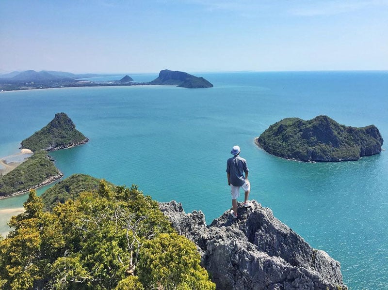
Website 13. On the Water’s Edge – Khao Lom Muak (เขาล้อมหมวก)
A 5-hour train journey from Bangkok, Prachuap Khiri Khan and Ao Manao Beach is the type of place you can sit yourself on the seashore, sip on a cold beer and watch the world go by. This isn’t the restless piece of Thailand where sunburnt tourists buy cheap knick knacks off beachcombing vendors. It’s a slow paced, sunset watching destination.
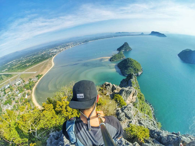
But, if you’ve had enough time to veg out, you’ll want to set your sights on Khao Lom Muak, the large mountain visible from the beach.
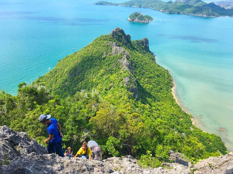
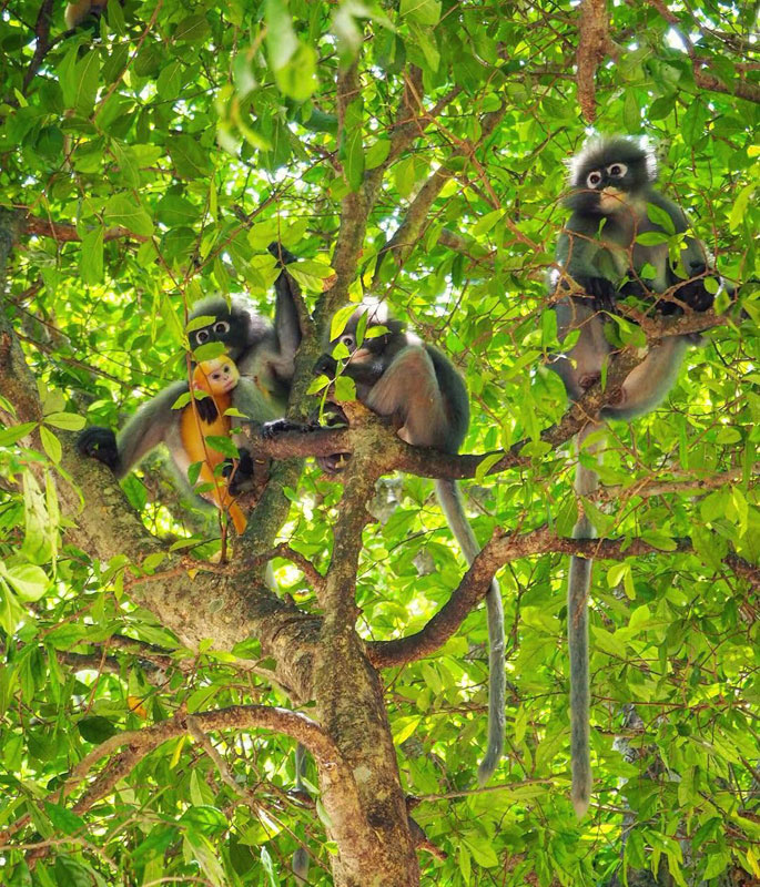
The hike to the top is strenuous but the view is oh-so-worth it. At the beginning, you’ll face 497 steps before reaching the ropes. Remember to say hi to the resident langurs. These guys are super cute!
Once you reach the ropes, use them to help pull yourself up the rock face. Don’t look down! On top, a seemingly endless view of sapphire blue seas greets you.
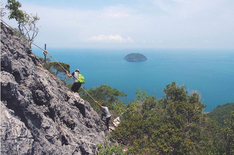
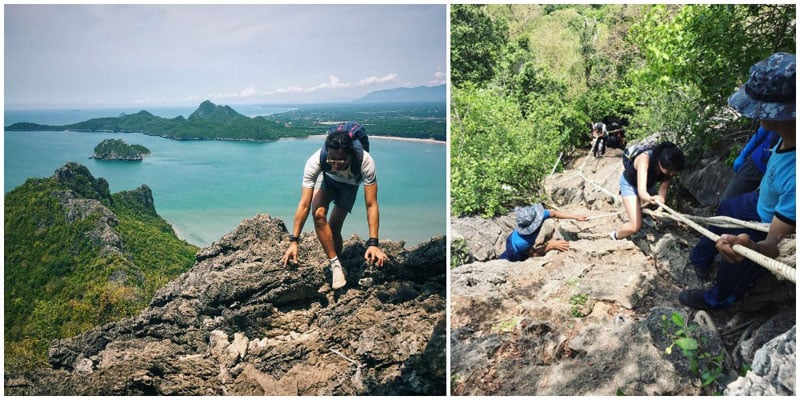
One last tip – be sure to take this hike in the morning. The afternoons in southern Thailand can be scorching hot, and there is little shade near the top of Khao Lom Muak.
Khao Lom Muak
Address: North Horn Ko Lak, Mueang Prachuap Khiri Khan District, Prachuap Khiri Khan 77000, Thailand
Difficulty Level: 7/10
Getting there: Take the train to Prachuap Khiri Khan and catch a mototaxi toward Ao Manao Beach in order to reach the Wing 5 Base. Alternatively rent a bicycle and cycle yourself there. The hike starts at the bottom of the mountain within the base. (Coordinates: 11.785042, 99.816116)
Entrance fees: Free
14. A Multi-Day Trek to the Heavens – Mount Mokoju (ยอดเขาโมโกจู)
For the hard-core hikers out there comes this multi-day trek to one of Thailand’s highest peaks. Situated in Mae Wong National Park to the northwest of Bangkok, scaling Mount Mokoju can be completed in 3 or 5 nights.
The difference in time depends on where you start. Either you walk into the forest on the first day for approximately 10 hours or you ride in the back of a truck/tractor to the first camp. From there it is only uphill.
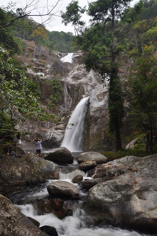
Leaving the first camp, you will walk for several hours, stopping at the second camp overnight and taking an optional hike to a nearby waterfall.
The next day is a full day of uphill hiking. It’s 8 kilometers as the crow flies, but much further than that after you account for all the twists and turns. The third camp is quite close to the summit of Mount Mo-Ku-Ju so that you can finish the climb in time for sunset then wake the next morning and enjoy sunrise on top of the mountain as well.
From there, it’s all downhill, physically speaking. After setting your eyes on the beautiful sunrise, you’ll hike all the way back down to the first camp where you’ll spend your final night. Then, either hike out of the forest or take the truck out to the starting point.
Because this is a complicated and strenuous hike, a park guide is required.
Mount Mokoju (ยอดเขาโมโกจู)
Address: Khlong Lan 62180, Thailand
Contact: +66 90 457 9291
Difficulty Level: 9/10
Getting there: Make your way to Khlong Lan Village. From there, travel down Route 1117 which terminates at Mae Wong National Park. Your trek begins another 9km from here at the park’s visitor center. (Coordinates: 15.813198, 99.148113)
Entrance fees: USD $5.80 / approx. 200 Baht (for foreigners
Website 15. An Alternative to Temples – Khao Luang Mountain Sukhothai (เขาหลวง)
In the Sukhothai region, Ramkhamhaeng National Park is home to a small mountain range known as Khao Luang. Hiking to the top of these mountains at 1,200 meters is a great 2-day excursion if you’re already tired of looking at temples.
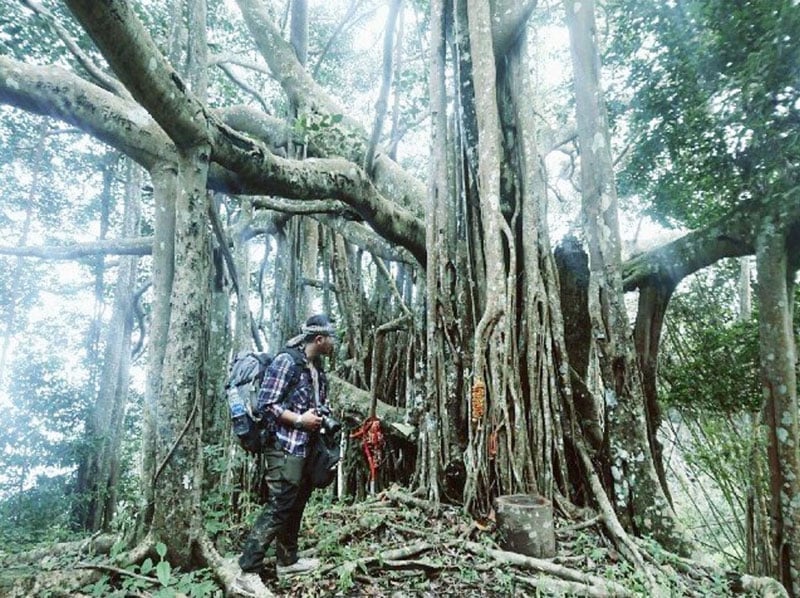
The 4km trail starts at the park headquarters and features 4 viewpoints on the way up. Each of these looks over the surrounding mountains and a few even showcase Sukhothai itself. On the trail, you might see bamboo forests, enchanting caves and huge dipterocarp trees.
The hike itself can be fairly challenging. In total, it takes 4 hours to cover the 4 kilometers, and no one is allowed to start hiking after 1.30pm.
If you choose, you can complete the Khao Luang hike in a single day or stay overnight. Of course, we recommend the overnight stay. Tents can be rented from the park for 250 Baht or you can bring your own and camp for 30 Baht. The campsite has great views of the nighttime sky and the sunrise. For epic sunset views, the viewpoint can be found within a kilometer of your lodging.
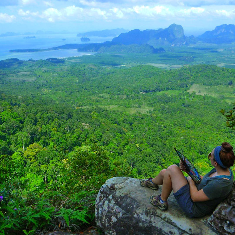
 Phoot via dragonthailand
All in all, Ramkhamhaeng National Park offers easy access from Sukhothai, a moderate to difficult level trail and great camping. We definitely would recommend the trip if you’re in the area.
Khao Luang Mountain Sukhothai
Address: Na Choeng Khiri, Khiri Mat District, Sukhothai 64160, Thailand
Contact: +66 86 895 6388
Difficulty Level: 6/10
Getting there: From Sukhothai, take Route 1272 south. After 15 kilometers turn right at the signs for the national park. You should reach the park headquarters and the trailhead after about 15 kilometers. (Coordinates: 16.866739, 99.653333)
Entrance fees: USD $5.80 / approx. 200 Baht (for foreigners)
Website 16. On the Edge of Thailand – Doi Ang Khang (จุดชมวิวม่อนสน)
Located on Thailand’s border with Myanmar, Doi Ang Khang National Park is a fabulous day trip or overnight trip from Chiang Mai. Here you’ll find fascinating villages, the King’s nature project and fabulous views.
Getting to Doi Ang Khang can be a challenge. The road is steep and not for new divers, so it’s best to either hire a good car or a good driver.
Once at the top of this 1,928m mountain, you’ll be greeted by many attractions. First and foremost is the viewpoint. Just off the road, there’s a camping area called Kiu Lom Viewpoint which has great sunset and sunrise views. Tents can be rented for overnight stays.
Further on you’ll find several different villages. Some of these have a distinctly Chinese feel as some KMT regiments settled in the area after fleeing to Thailand. Others are more Burmese. The No Lae people immigrated to Thailand from Burma and still speak their own language.
Perhaps the most important part of Doi Ang Khang National Park is the Royal Agricultural Station. Started by King Bhumibol Adulyadej, this project was meant to bring peace to the war-torn border area and encourage locals to grow something other than poppy.
The best hikes in the park are through the Royal Agricultural Station where you’ll be greeted with colorful gardens and nice views over the mountains that lead into Myanmar’s Shan State.
Doi Ang Khang (จุดชมวิวม่อนสน)
Address: Doi Ang Khang, Amphoe Fang, Chiang Mai
Difficulty Level: 1/10
Getting there: Doi Ang Khang is about 3 hours from either Chiang Mai or Chiang Rai. Take Route 107 then turn onto Route 1249. This is a winding hill that ascends at a steep grade. At the end of it, you’ll find Doi Ang Khang. (Coordinates: 19.862429, 99.051563)
Entrance fees: USD $1.44 / approx. 50 Baht
Website Are there any more hiking trails and mountains in Thailand with magnificent views that need to be on this list? Let us know in the comments below!
Travel Writer

 简体中文 (Chinese)
 Bahasa Indonesia