
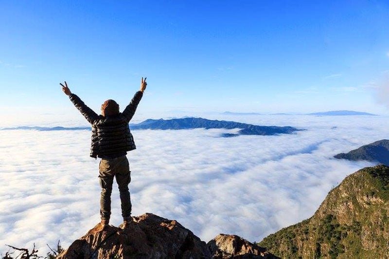
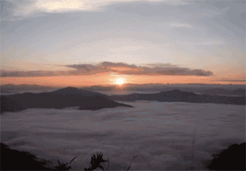
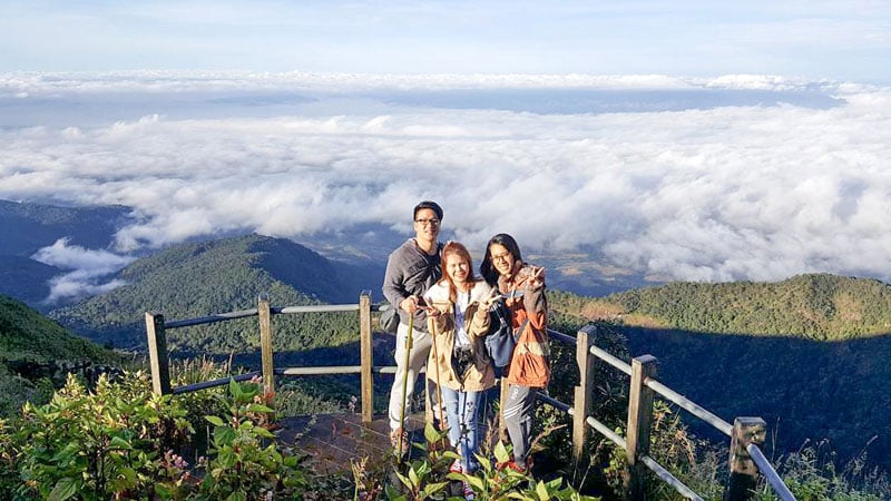
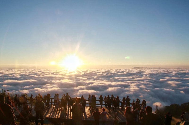
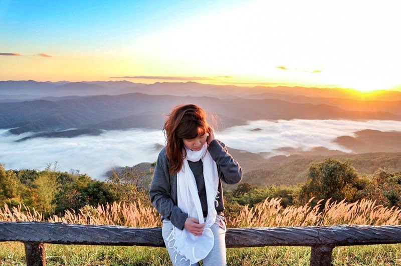
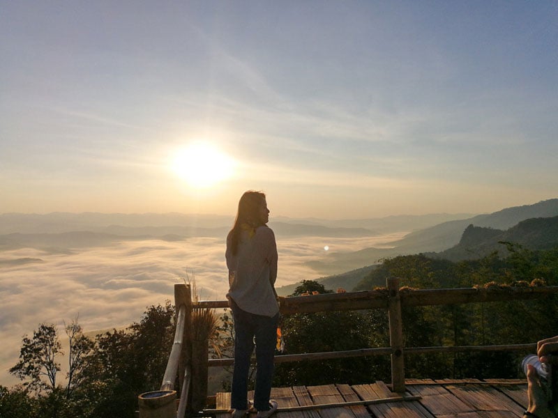
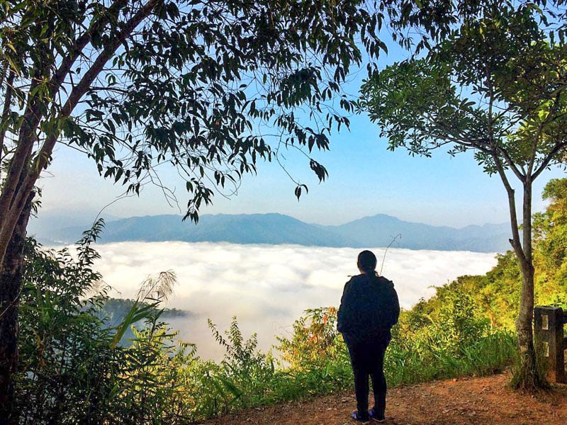
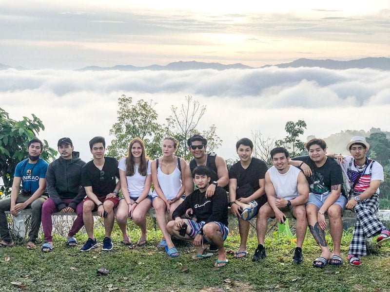
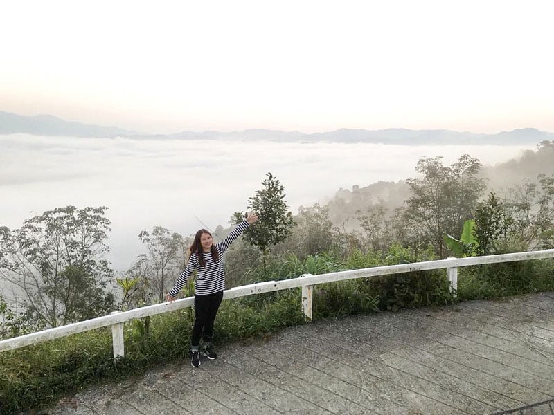
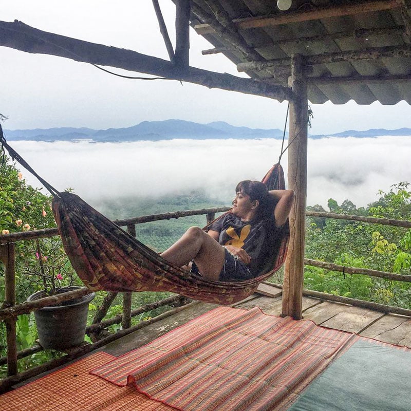
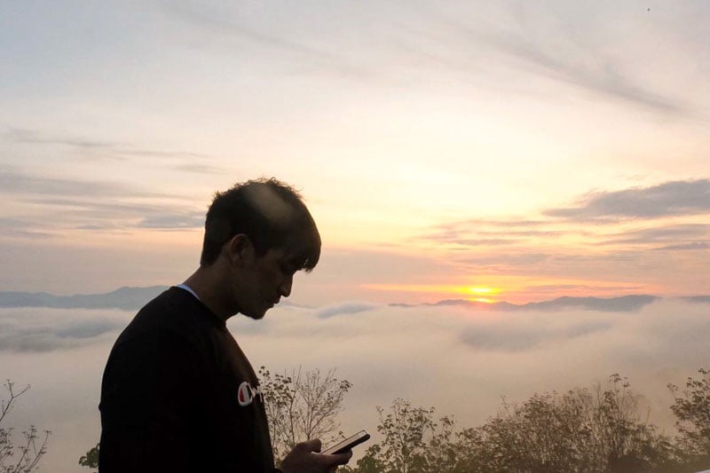
We all know that nature is pretty amazing right? It provides endless beauty for us to enjoy. Sometimes Mother Nature really blows us away with her nature phenomenons that leaves us breathless in a good way.
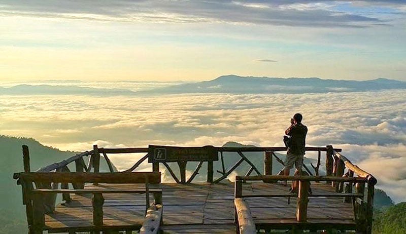
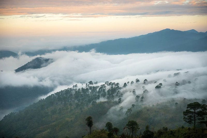
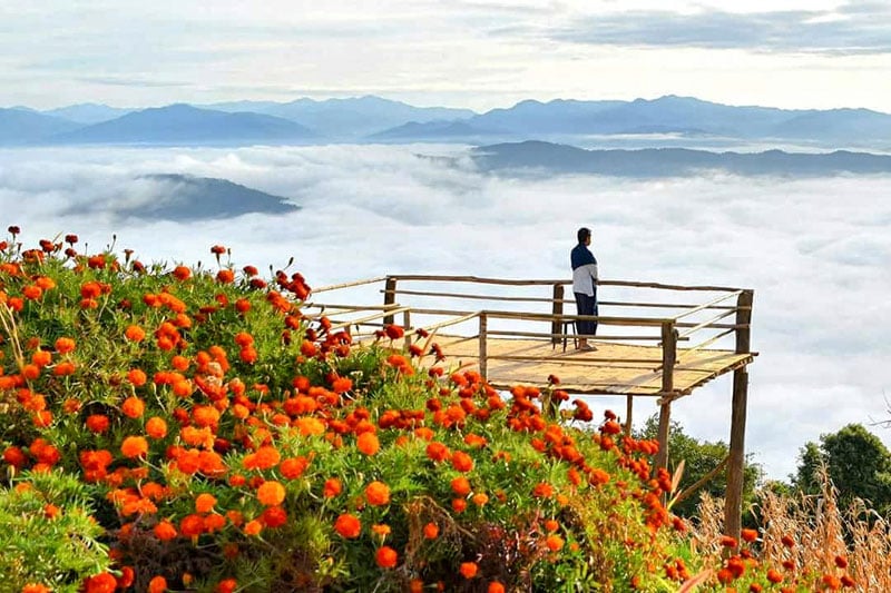
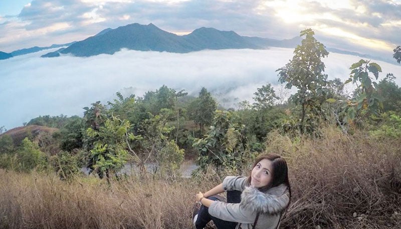
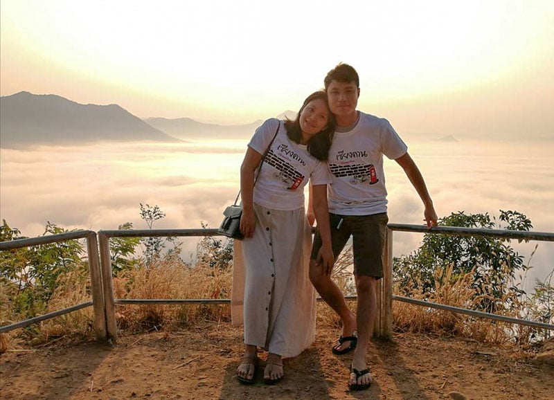
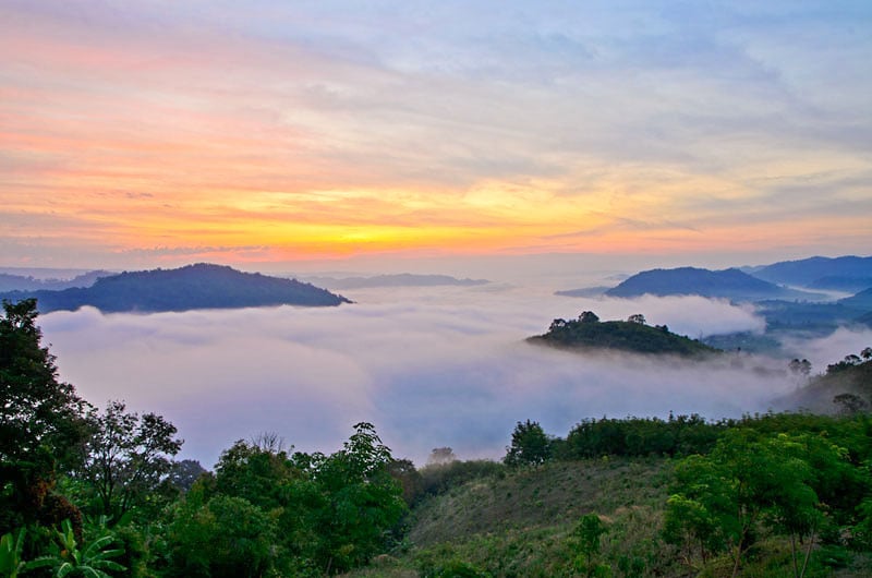
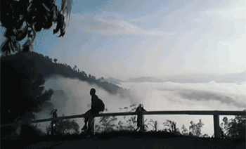
If you ever see delicate soft white clouds rolling around at the bottom of a valley, it sometimes stretches far out to the horizon looking just like water in the ocean. This is what we’re talking about – looking at a sea of mist.
If you haven’t witnessed this beauty for yourself, we’ve compiled a list of top places to view this nature phenomenon all over Thailand.
Also read:
19 unique and magical places to visit in Thailand with fairies, dragons and flaming cliffs
10 water villas in Thailand with stunning water views that will take your breath away!
13 Hiking trails and mountains in Thailand with the most majestic views
You’d be surprised, most of these places are not hard to reach. Is this Heaven or Earth? You decide!
PS: Depending on where you’re travelling to in Thailand, we’ve sorted out the best places to see the sea of mist according to the regions:
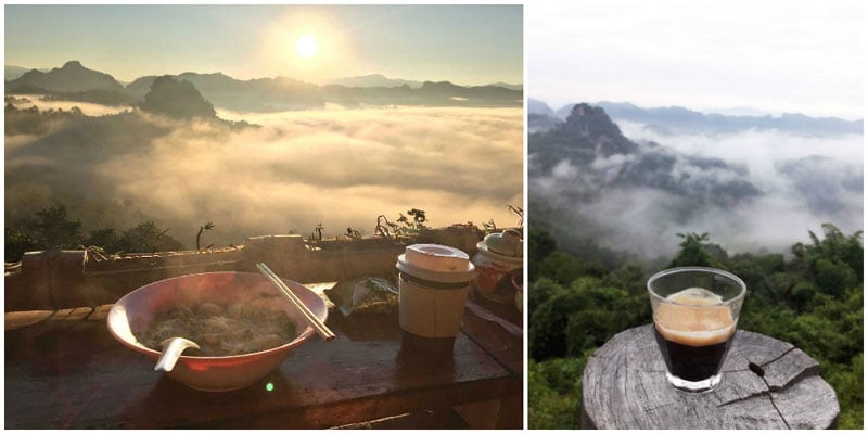
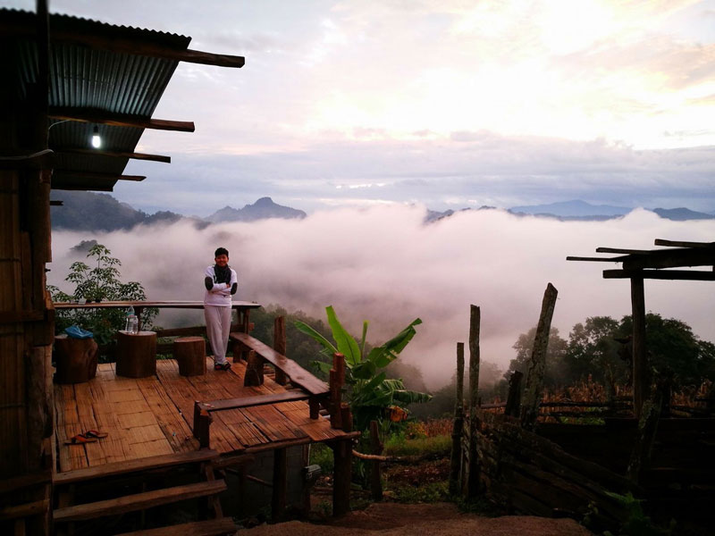
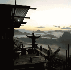
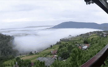
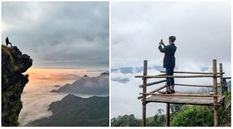
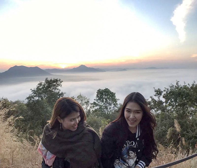
1. Eat a bowl of noodles in the sea of mist – Ban Ja Bo Village, Mae Hong Son (บ้านจ่าโบ่ จังหวัด แม่ฮ่องสอน): Northern Region
Your legs are dangling in the air, with a bowl of hot noodle soup that costs one dollar on the table. In front of you, there’s a panoramic view of a sea of mist filling up the mountain valley down below.
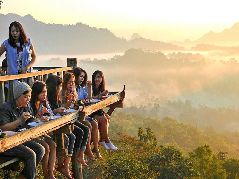
That’s what we call ‘a dollar dish with a million dollar view”
Ban Ja Bo Village is situated on Phu Pha Mok Mountain close to Myanmar border in Mae Hong Son province. In this small hill tribe village, the villagers live quietly with their traditions, but willingly welcome you to their homes.
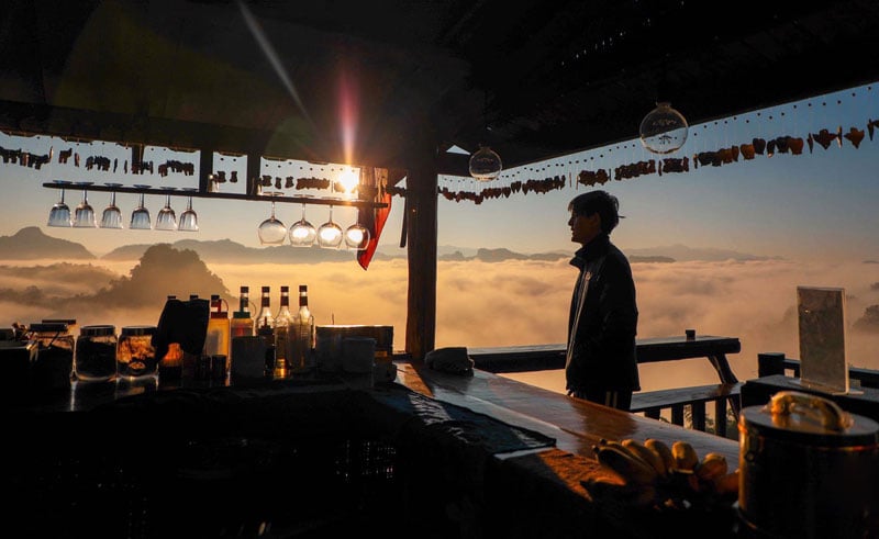
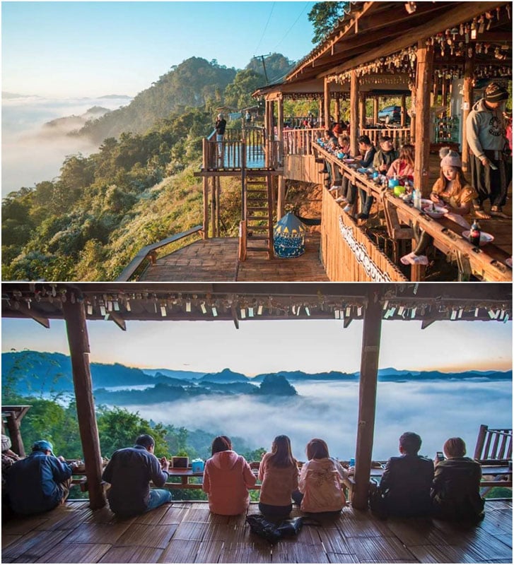
At the entrance of the village, this roadside wooden shack sells only noodles and coffee, and the good view is complimentary. It opens early in the morning for the mist hunters but if you come in later in the day, you still can get a good view of the mountain.

If you’re not hungry, there’s also another viewpoint along the road in the village. The village is easily reachable by car, but the road is notorious for its countless curves. You can stay at a few homestays at the village too, if you’d like to immerse yourself in the culture of this unspoiled village.
Ban Ja Bo Noodle
Address: Pang Mapha, Pang Mapha District, Mae Hong Son 58150, Thailand (Coordinates here)
Opening hours: Wed-Mon, from 6.30am to 4.30pm (Closed on Tuesdays)
Price: From USD $1 / approx. 30 Baht
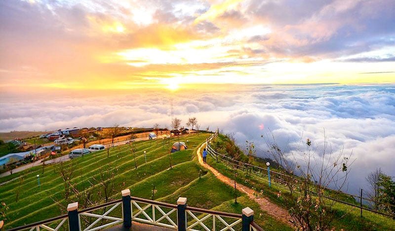
2. You might think it’s Ha Long Bay in Vietnam but it’s – Phu Lang Ka , Pha Yao (ภูลังกา จังหวัดพะเยา): Northern Region
*Spoiler alert!* That’s not water!
If you’re familiar with the famous Ha Long Bay in Vietnam, you’d recognise the towering limestone island topped with a thick forest rising from the water.
That is what Phu Lang Ka looks like. Instead of water, you’ll see the sea of mist creeping and rolling on the ground with limestone mountain tops peaking through.
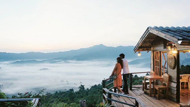
Still a lesser known destination to travellers, it offers a very unique sight unlike others. It’s equally beautiful during both sunrise and sunset.

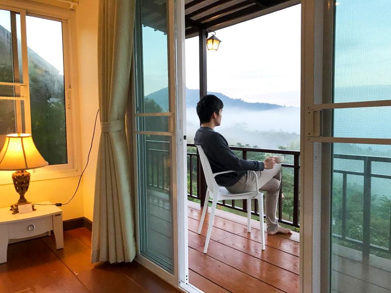
The best spot to see the mist is at Phu Lang Ka Resort where you can get the best view from your balcony. There’s also a café for you to chill at, sip coffee and enjoy the unforgettable view.

You can also visit Pang Kha Royal Project Development Center, 30 minutes from the resort, to explore your way through wintry flowers, fruit, and vegetable farms.
Phu Lang Ka Resort
Address: 125 Moo 4 Tambon Pha Chang Noi, Amphoe Pong, Chang Wat Phayao 56140, Thailand (Coordinates here)
Getting there: Fly to Chiang Rai International Airport and rent a car. Get on ชร.5023. Drive from Route 1020, Route 1292, พย.4033 and Route 1148 to ตำบล ผาช้างน้อย for 2 hours and 20 mins before turning left and the destination will be on the right.
Contact: 089-191-0291 , 081-023-2421
Rate: A cottage per night USD $20-85 / 700-3000 Baht. Tent for rent from USD $8.50-14 / 300 -500 Baht. Tent slot is USD $4.20 / 150 Baht (if you bring your own tent)
Best time to visit: All year round, but best from November to February.
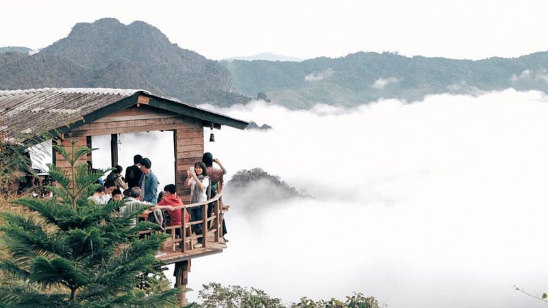
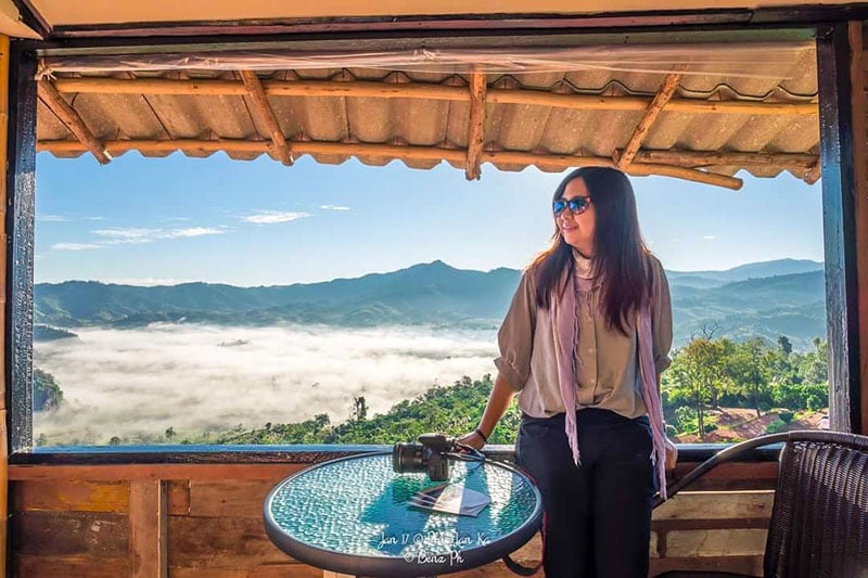
Website 3. Send a postcard from the edge of the mist – Khao Kho, Phetchabun (เขาค้อ เพชรบูรณ์ ): Central Region
Khao Kho is a mountain in Phetchabun province. It is very rich with thick forests, valleys, waterfalls, and rivers. It’s also an extremely popular vacation spot for locals who come for its refreshing cool climate.

Unlike other locations, the best time to see the sea of mist/clouds at Khao Kho is during the rainy season from July to October – when the forest is a luscious green. Your chance to see the misty view is almost every day. Even better when the mist stays till 10am, unlike during cold season when the mist disperses around 7am.
Want to know a secret? The mist is the most spectacular in the morning after it rains the day before.
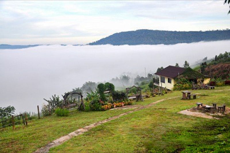
Talk about options. Khao Kho has many viewpoints with unique perspectives all over the area and in all directions. The area also has many resorts ranging from luxury 5-star to budget hotels for travellers that offer spectacular views of the mist from your bed. We’re not kidding.
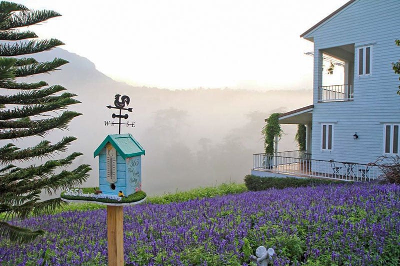
Otherwise, you can also view the mist from gorgeous cafes like Tanrak Talaymok with its views looking out over the valley, flowers – and it serves great food too!
Khao Kho has many other attractions for you to explore, such as Khao Kho Royal Palace, stunning Buddhist Temples, beautiful waterfalls, and an adventure park with outdoor activities for those craving a good adrenaline rush.
Tanrak Talaymok
Address: Khao Kho, Khao Kho District, Phetchabun 67270, Thailand (Coordinates here)
Getting there: Fly to Phetchabun Airport and rent a car. From there, it’s less than an hour’s drive. take Route 2215 to ตำบล บุ่งน้ำเต้า for 5 mins before turning left onto Route 2001 for 3 mins. Then take Route 2302 to Route 2325 in ตำบล เขาค้อ for 36 mins. Turn right onto Route 2325 for your destination.
Contact: +66 91 453 9888
Opening hours: Daily from 7am to 8pm
Price: From USD $2.80 / 90 Baht (for a smoothie) – (MUST-TRY their cabbage dish! It’s really good! But be sure to ask for less salt, chillies if you’d prefer)
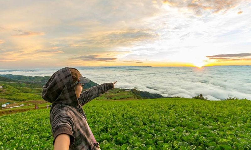
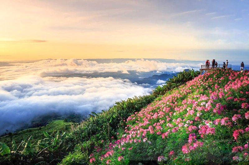
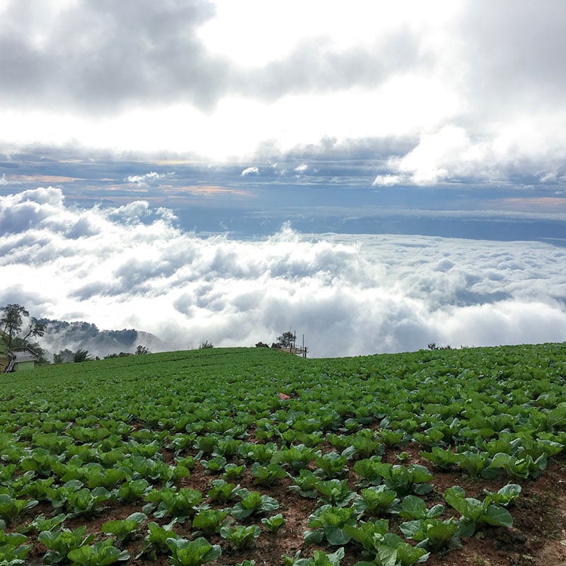
Website 4. Cold and misty with Thai Sakura too – Phu Tub Berk, Phetchabun (ภูทับเบิก จังหวัดเพชรบูรณ์): Central Region
We can personally vouch for a visit to this place, having travelled there in December 2017 and experiencing 16º weather here. At 1768m above sea level, Phu Tub Berk is the highest point of Phetchabun.
The area is known for its cabbage farm – claiming to be the biggest cabbage farm in the world. They grow the cabbages along the slope of the hill. This makes a fantastic vantage point to see unobstructed panoramic view of the mountain and the mist. (ALSO, did you know that fruits and vegetables grown on a mountain tastes the sweetest?!?!)

Resorts and homestays in Phu Tub Berk offer a cottage on the cliff, or you can rent a tent for maximum view.
If you come during rainy season when the cabbages are ready to be harvested – you can see a field of green cabbages stretching down the hill and sometimes disappearing into the mist.
Even though it’s in the central region, Phu Tub Berk is cool all year long. You get a chance to see the mist/clouds most of the year – if the days are dry, there’s a less chance you will see.
PS: Don’t miss the gorgeous Thai Sakura in full bloom during December to January!

Phu Tub Berk, Phetchabun (ภูทับเบิก จังหวัดเพชรบูรณ์)
Address: Wang Ban, Lom Kao District, Phetchabun 42120, Thailand (Coordinates here)
Getting there: Fly to Phetchabun Airport, and rent a car. It’s a one hour drive on Route 2372 and Route 2331 to ตำบล บ้านเนิน. Turn left onto Route 2331 and take the winding road till you come across the National Park’s entrance on your right.
Contact: +66 84 822 2625
Opening hours: Daily 24/7
Entrance fee: Free!
Best time to visit: Best to visit from August to February. If you visit during the rainy season from August to November – the cabbages are at peak. If you visit during the colder season from December to January – Thai Sakura is in full bloom!
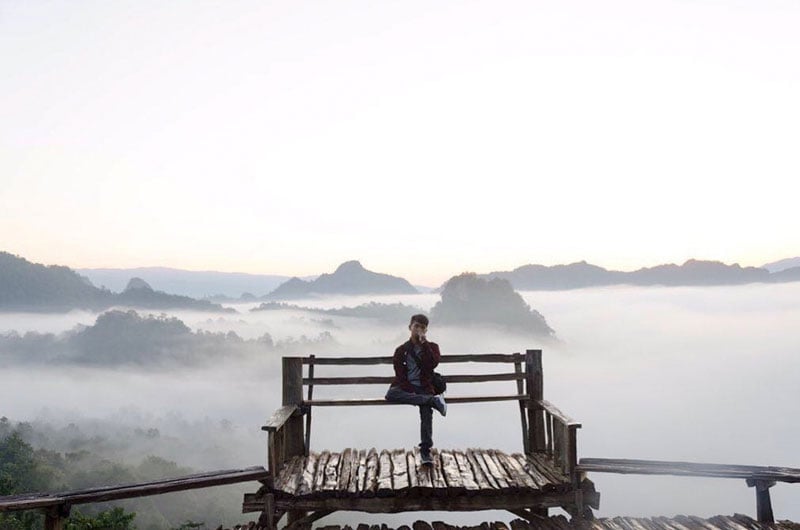
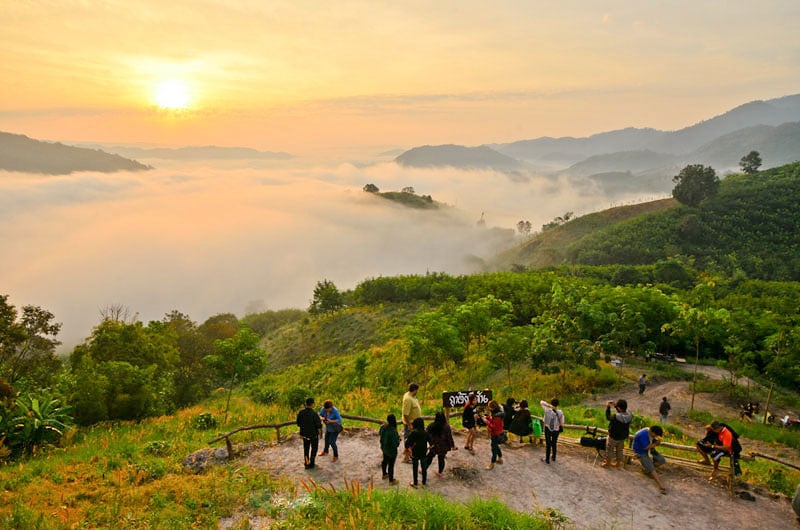
5. Two heavenly viewpoints and the Orchid Tree Festival – Phu Chi Fa, Chiang Rai (ภูชี้ฟ้า จังหวัดเชียงราย): Northern Region
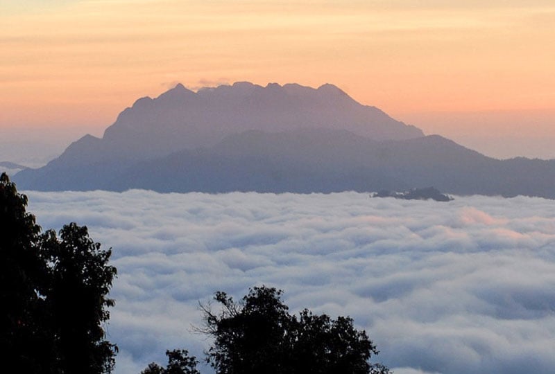
Located in Chiang Rai Province, 1628 meters above sea level. Phu Chi Fa is one of the most popular sites to view the sea of mist.

The name, Phu Chi Fa, means “Point to The Sky Mountain”, and comes from a very unique peak that angles 45º pointing up into the sky. (Now you don’t have to scratch your head wondering why people are taking pictures with their fingers pointing up to the sky.)

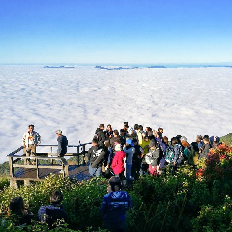
There are two best viewpoints in Phu Chi Fa.
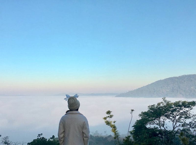
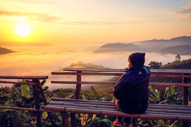
The first is the summit. To get to the summit, you need to take a moderate hike about 800 meters from the base. Once you get there, you’ll be rewarded with a beautiful view of soft glowing sunrise peeking through sea of mist rolling around the valley below.
The second is the flat plain before reaching the summit. Here you can see the summit which inspired the name of the mountain.
PS: If you come during New Year, you will get to see the traditional New Year’s celebration of the hill tribe village in the area.
Phu Chi Fa , Chiang Rai (ภูชี้ฟ้า จังหวัดเชียงราย)
Address: หมู่ที่ 10, ต.ปอ อ. เวียงแก่น จ. เชียงราย, 57310 Tambon Tap Tao, Amphoe Thoeng, Chang Wat Chiang Rai 57310, Thailand (Coordinates here)
Getting there: Fly to Chiang Rai International Airport and rent a car. Take the 2 hour drive to the border. From the airport, get on ทางแยก สนามบิน onto ชร.5023. Then, take ทางหลวงชนบท to ชร.4013 for 13 minutes. Follow Route 1173 and Route 1326 for the next half an hour before turning left at Route 1152. Continue on Route 1174 and Route 1020 to ชร.4018 in ตำบล ยางฮอม for 24 mins then turn left onto ชร.4018 for 10kms, continue onto ตำบล ตับเต่า, then Route 1093 to your destination.
Contact: 053-717-433, 053-744-674-5
Opening hours: Daily from 5am to 6pm
Best time to visit: To see the sea of clouds, come between November to February. (There’s an Orchid Tree Festival every February, and this is when the Orchid trees on the sides on the road will be in full bloom with white flowers.)
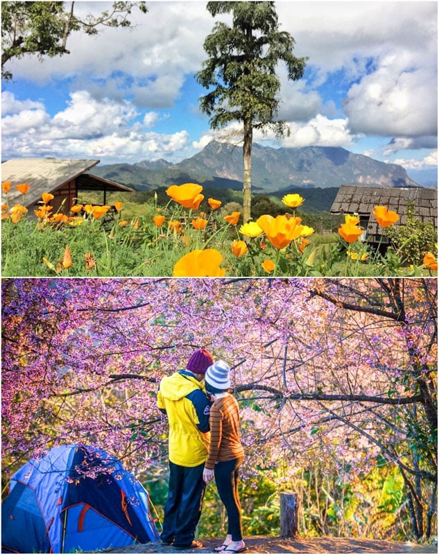
Website 6. Take a picture perfect, 100 likes guaranteed shot – Doi Mae Ta Man and San Pa Kae, Chiang Mai (“ดอยแม่ตะมาน” และ “สันป่าเกี๊ยะ” จังหวัดเชียงใหม่): Northern Region
If you want a 100 likes guaranteed picture of you and the misty sea of clouds – you must visit San Pa Kae viewpoint, located in San Pa Kae Agricultural Station in Chiang Mai.
What makes this spot picture perfect is the majestic Doi Luang Chiang Dao Mountain, strategically placed as a perfect backdrop of the shot – as if there’s a big island floating amidst the sea of clouds.

But wait, there’s more! A field full of poppy flowers in the area adds a pop of stunning red and yellow.
Only 200 meters from San Pa Kae, the nearby Doi Mae Ta Man viewpoint located at Doi Mae Ta Man Water Management Unit is as beautiful as the San Pa Kae. It’s a perfect spot to view the sunset, with a chance to see the sea of clouds in the evening too.
Both viewpoints are reachable by car but because it’s a rough terrain, 4 wheel drives are highly recommended. You can bring your own tent to camp or rent a cottage for overnight stay.
PS: If you come during mid-December until January, you will be in awe with the pink Thai Sakura in full bloom.
Doi Mae Ta Man and San Pa Kae, Chiang Mai
Address: Kuet Chang, Mae Taeng District, Chiang Mai 50150, Thailand (Coordinates here)
Getting there: Fly to Chiang Mai International Airport and rent a car. Drive North on ถนน โชตนา and ชม.3052 to ตำบล กื้ดช้าง for an hour. Turn right before Maetaman Elephant Camp & Bamboo Rafting and keep your eyes peeled for a turning on the right after ภูไผ่งาม รีสอร์ท and your destination will be straight dead ahead.
Contact: 0 2579 7587
Opening hours: Daily from 9am to 5pm
Entrance Fee: Free! For camping (bring your own tent only), fee for a tent spot is USD $2.85/100 Baht for big tent and USD $ 1.40/50 Baht for small tent. Plus USD $1.40/50 Baht per person for maintenance fee. For cottage rental USD $28.5 / 1000 Baht for big cottage and USD $14.25/500 Baht for small cottage. Reservation is required. (Contact High Altitude Research Center, Chiang Mai University at 0 5322 2014.)
Best time to visit: See the mist from November to February. Don’t forget that the Thai Sakura blooms from mid-December to January!
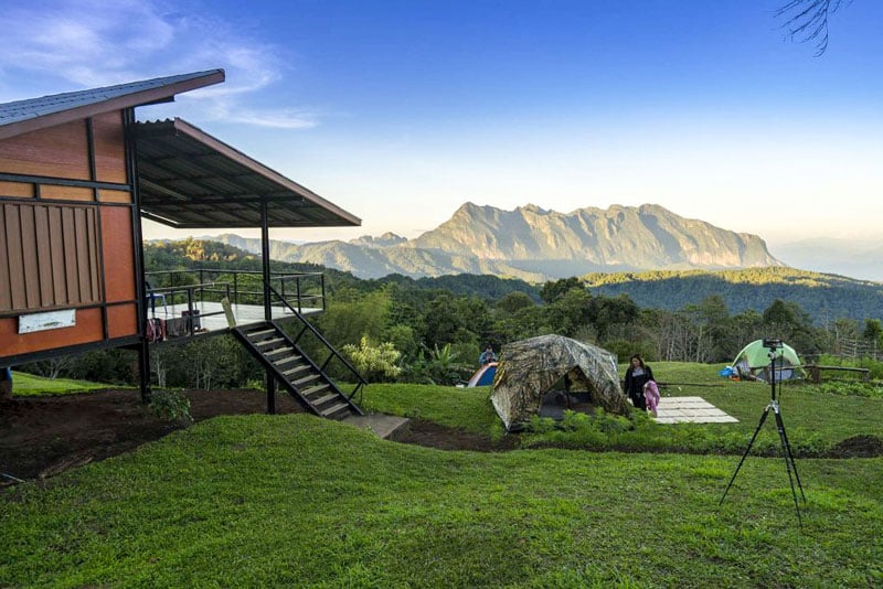
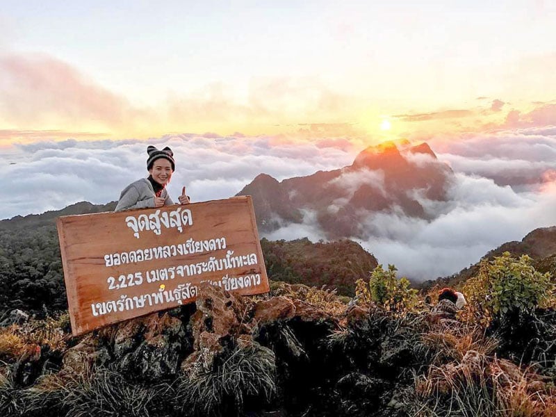
Website 7. Conquer the beast of hiking – Doi Luang Chiang Dao, Chiang Mai (ดอยหลวงเชียงดาว จังหวัดเชียงใหม่): Northern Region
The journey might be tough but the reward is priceless. Located in Chiang Mai at 2235m above the sea, Doi Luang Chiang Dao is the third highest mountain in Thailand.

As part of the Wildlife Sanctuary, cars are not allowed here, and the only way to get to the top is to hike. The hiking trail to the campsite is 6-8km and is known to be strenuous – approximately 5-6 hours hike.
You will have to spend a night (or two) at the campsite in the wilderness under millions of stars and the Milky Way. Sounds incredibly romantic and rewarding!
From the campsite, another trail (45 minutes to an hour hike) leads you up to the viewpoints.
Doi Kew Lum viewpoint is best to view the sea of clouds at sunrise. The second viewpoint is at the summit, best for viewing the sunset. When you are here, see if you can spot Pyramid Peak and Three Brothers Peak.

Doi Luang Chiang Dao, Chiang Mai (ดอยหลวงเชียงดาว จังหวัดเชียงใหม่)
Address: Chiang Dao, Chiang Dao District Chiang Mai 50170 Thailand (Coordinates here)
Getting there: Fly to Chiang Mai International Airport and rent a car. It’s a 2 hour drive through ถนน โชตนา to Route 1359 (in ตำบล เชียงดาว) and when you hit Chiang Dao, Head north on Route 1359 toward ซอย 15 หมู่ 6 and turn left onto ซอย 25 หมู่ 6 for 2.3km and continue onto ชม.3024. Keep going straight and your destination will be on your left.
Contact: 089-955-1471 (for permit)
Opening hours: 24/7 (The Wildlife Sanctuary opens only from November to March)
Entrance Fee: You’ll need to get a permit 15 days in advance to hike and camp here. Only 150 people are allowed in the Sanctuary per day. Entrance Fee to the Wildlife Sanctuary is USD $0.57/20 Baht per person, USD $0.85/ 30 Baht per car, and USD $0.85/ 30 Baht per tent. Plus USD $17.00/ 600 Baht deposit for trash.
(Many local tours provide all the gear, transportation, food, water, fees, and porter services included in their tour price.)
Best time to visit: The Wildlife Sanctuary opens only from November to March.
8. Is this Japan? See Thai Sakura and the sea of clouds! – Doi Pha Tang, Chiang Rai (ดอยผาตั้ง จังหวัดเชียงราย): Northern Region
It’s located in Chiang Rai, and approximately 30 km from Phu Chi Fa. Doi Pha Tang is another location where you can see the breathtaking view of fluffy clouds everywhere, both during sunrise and sunset..
Make sure you have plenty of room in your camera. As you hike up along a 900m path from the parking lot, they are many stops along the way for you to take pictures with and of the incredible view.
Look out for Lover Gate viewpoint, Chinese Pavilion viewpoint, and Chong Pha Kad!
The best spots to see the sea of clouds are at Hill 102 and Hill 103 viewpoints at the top of the mountain, where you can see the panoramic view of the whole mountain covering in the mist.

If you visit during the right season, you might even catch the stunning vision of the mountain painted in pink with blooming Thai Sakura!

PS: If you’re here, you should consider visiting Chinese Village that’s nearby.
Doi Pha Tang, Chiang Rai (ดอยผาตั้ง จังหวัดเชียงราย)
Address: Po, Wiang Kaen District, Chiang Rai 57310, Thailand (Coordinates here)
Getting there: Fly to Chiang Rai International Airport and rent a car. Take the 2 & a half hour drive to the border. From the airport, turn left onto ทางแยก สนามบิน onto ชร.5023 and take ทางหลวงชนบท to ชร.4013. Continue on ชร.4013. Take Route 1326, Route 1174 and Route 1020 to ชร.4018 in ตำบล ยางฮอม for about an hour before turning left onto ชร.4018. From there just follow Route 1155 to ทางหลวงชนบท ชร.4029 in ตำบล ท่าข้าม and you’ll reach your destination at ตำบล ปอ in 30 mins.
Opening hours: Daily from 8am to 6pm
Best time to visit: To see the sea of clouds, visit between November to February. To see the Thai Sakura in full bloom, visit from the end of December to the beginning of February.
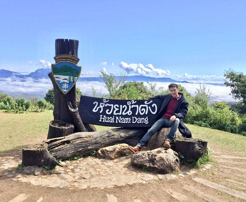
Website 9. So easy to get to this garden in the sky – Huai Nam Dang, Chiang Mai and Mae Hong Son (ห้วยน้ำดัง จังหวัดเชียงใหม่ และ แม่ฮ่องสอน): Northern Region
Huai Nam Dang National Park is one of the top spots to see the sea of clouds in Thailand.
Not only can it provide a picturesque view of the mist, but also it is very easy to get to. It’s so vast that covers two provinces – Chiang Mai and Mae Hong Son
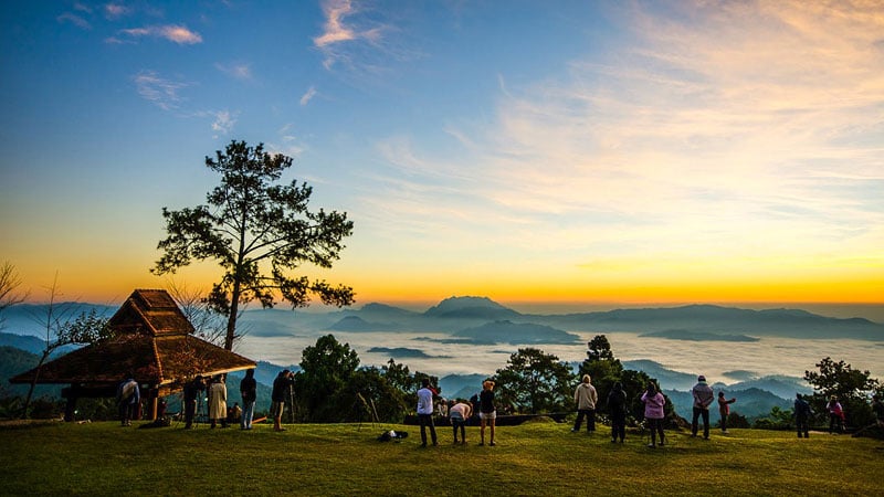
You can drive up to Doi Kio Lum (ดอยกิ่วลม) viewpoint, 1615m above sea level in the early morning – and wait for the sun to rise above the misty clouds, which envelope the entire valley of Huai Nam Dang Mountain Range.
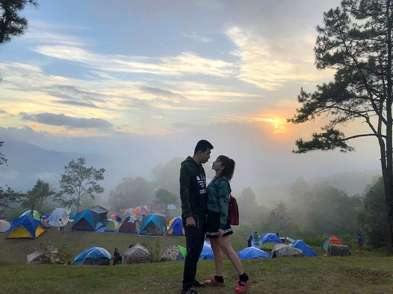
Or you can find a spot to set up a tent and stay overnight.
The well-manicured landscape adds an extra degree of spectacular – and if you visit in February, the area is filled with brightly coloured flowers cascading down the hill. It’s almost as if you’re looking at the Garden of Eden.
Because of the unique geography and climate, you will be able to witness the sea of clouds all year round, but best to visit from November to February when the air is cooler and there’s less rain.
Once you soak up the beauty of sunrise in the morning, you can visit nearby attractions within the National Park such as Huai Nam Dang Waterfall and Pa Pae Hot Springs. You can also relax and chill at a coffee farm and enjoy the beautiful winter flowers.
Huai Nam Dang, Chiang Mai and Mae Hong Son (ห้วยน้ำดัง จังหวัดเชียงใหม่ และ แม่ฮ่องสอน)
Address: Moo 5, Tombol Kid Chang, Amphoe Mae Taeng, Chiang Mai (Coordinates here)
Getting there: Fly to Chiang Mai International Airport and rent a car. From the airport, drive to ถนน โชตนา and Route 1095 to ชม.4030 in ตำบล ป่าแป๋ for 2 h 14 min. Turn right onto ชม.4030 and your destination will be on the left.
Contact: 0 5324 8491, 0 5322 9636, 0 2562 0760
Opening hours: Daily from 8am to 6pm
Entrance fee: Entrance Fee for National Park USD $8.50 / 300 Baht (for foreigners), USD $4.20 / 150 Baht (for children); USD $1.40/50 Baht (for locals), USD $0.60/20 Baht (for local children).
Best time to visit: The sea of clouds is available all year round, but the best time to visit is from November to February when temperatures are cooler and there’s less rain.
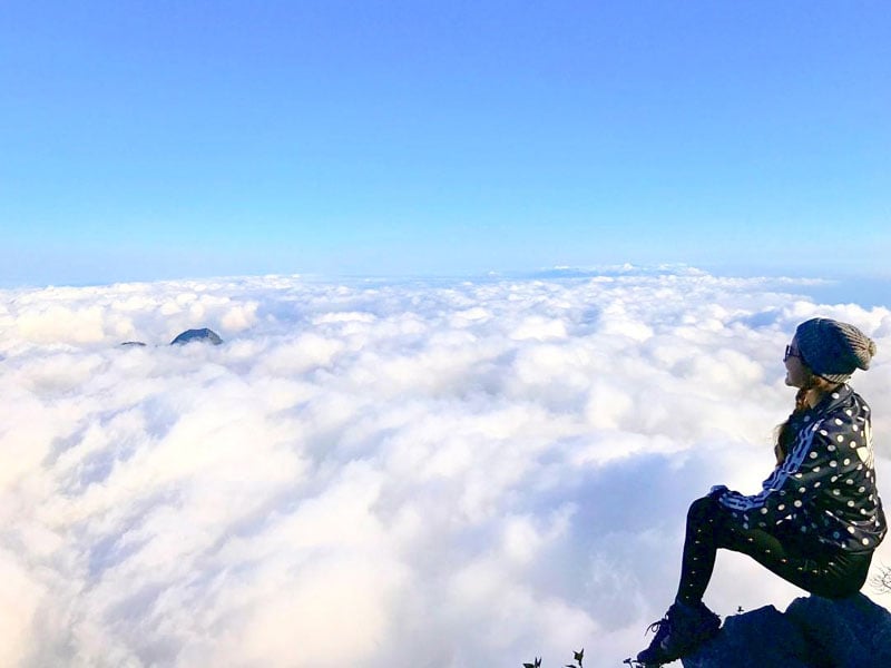
Website 10. Trekking to see nature wonders and the mist – Kew Mae Pan, Chiang Mai (กิ่วแม่ปาน จังหวัดเชียงใหม่): Northern Region
If you are a nature lover, you will love visiting Kew Mae Pan. Located in Doi Inthanon National Park, it’s also known as The Roof of Thailand.
Kew Mae Pan reaches high at 2,200m above sea level, just a few hundred meters shy from the highest peak of Thailand.
Get your comfortable shoes on and be prepared to walk. The path to get to the viewpoint is part of circular 2.7km nature trail. But don’t worry, it’s quite an easy trek (with some stairs). Plus there are a lot of Instagram worthy along the way to keep your camera busy for 2-3 hours.
You’ll reach the viewpoint halfway through the trail. After you pass the thick forest and waterfalls – you’ll come to the open grassland with spectacular panoramic views of the mountain and the sea of clouds as far as your eyes can see.

Here comes the fun part during the second half of the trek, you will walk along a narrow path on the ridge of the mountain – thrilling! The path is only 1 meter wide, so everyone must walk in a single file and be extremely careful.
If you visit in December, you will see red azalea (Thais call it ,“Thousand Years Red Rose”) in bloom along the cliff too.
After you finish the trek, don’t forget to stop at The Great Holy Relics Pagoda Nabhapolbhumisiri to see two beautiful pagodas on top of the summit.
Kew Mae Pan, Chiang Mai (กิ่วแม่ปาน จังหวัดเชียงใหม่)
Address: Ban Luang, Chom Thong District, Chang Wat Chiang Mai 50160, Thailand (Coordinates here)
Getting there: Fly to Chiang Mai International Airport and rent a car. Take the 2 hour drive to the West (towards Doi Inthanon National Park). From the airport, follow ถนนเลี่ยงเมืองสันป่าตองหางดง, Route 108 and Route 1009 to ซอย 1009 in ตำบล บ้านหลวง for almost 2 hrs and continue onto ซอย 1009. Destination will be 4 mins away on the left.
Contact: 053 286 729 (Visitor Center)
Opening hours: Daily from 6am to 4pm
Entrance fee: You’ll have to pay to enter Doi Inthanon National Park. USD $8.50 / 300 Baht (for foreigners), USD $4.20 / 150 Baht (for children); USD $1.40/50 Baht (for locals), USD $0.60/20 Baht (for local children). For the Nature Trail, you will require local guide which will cost USD $7 / 200 Baht for a group of 10.
Best time to visit: The National Park opens from November to May (closed during rainy season). The Nature Trail opens from 6am to 4pm. The best time to see the sea of clouds is from November to February.
11. How would you like to wake up to a million dollar view? – Doi Ang Khang, Chiang Mai (ดอยอ่างขาง จังหวัดเชียงใหม่): Northern Region
Imagine you wake up in the morning and look outside. You see the sun slowly rises above the sea of white fluffy could. That’s a million dollar view that you can experience at Doi Ang Khang in Chiang Mai province.
At 1787 meter above sea level, Mon Sone viewpoint is the best spot to view the mist. You can rent a tent for overnight stay. You can even order Thai BBQ set that comes with BBQ pan and yummy ingredients for you and your friends to enjoy cooking and the evening under the stars.
If you don’t want to stay overnight, you can always drive up to the viewpoint in the morning. Be careful while driving because there are many turns and curves on the way up the mountain.
As part of the Royal Agricultural Project, you can also visit cold climate flowers, vegetables, and fruit. Tea farm and hill tribe villages are not very far from Doi Ang Khang.
Doi Ang Khang, Chiang Mai (ดอยอ่างขาง จังหวัดเชียงใหม่)
Address: Doi Ang Khang, Amphoe Fang, Chiang Mai (Coordinates here)
Getting there: Fly to Chiang Mai International Airport and rent a car. From the airport, drive onto ถนน โชตนา to Route 1249 in ตำบล แม่สูน for 3 hours then follow Route 1249 to your destination in ตำบล แม่สูน.
Contact: 66 5381 0765-8 ext. 104 , 108
Opening hours: Daily from 9am to 5pm
Entrance fees: Entrance Fee to Doi Ang Khang National Park is USD $0.70/25 Baht. Tent rental is USD $6.40/225 Baht. Sleeping gear rentals are from USD $0.60 – $1.50/ 20 – 50 Baht. If you bring your own tent, the tent slot fee is 50 Baht. Reservation is recommended.
Best time to visit: See the sea of clouds from November to February. However, the area is cool all year round, great for those looking to escape to a cooler climate!
Website 12. Here’s where you can reach for the stars – Doi Samer Dao, Nan (ดอยเสมอดาว จังหวัดน่าน): Northern Region
This mountain is only 888m above sea level, don’t let the height of Doi Samer Dao fool you.
Located in Nan province on the border of Thai-Laos. The name “Doi Samer Dao”, translates to “ Star Level Mountain” because when you stand on this mountain, you will feel so close to the stars as if you can almost touch them – and you will have the photo to prove it.
Another special thing about Doi Samer Dao is the 360º view of the mountain range. You can view both sunrise and sunset here. The morning mist/sea of clouds appears in the valley between the mountains. It looks like a creamy white river flowing between the mountains rather than the sea.
You can see the mist all year, even during summer months – it might not be as thick – but it still looks like a river. The best time to see stars is from June to October, and best time to see the mist is from November to February when there’s a chance to see the mist covering the entire mountain.
Doi Samer Dao is part of Si Nan National Park which provides a campsite for overnight stay.
Not far from the National Park, you can also visit Sao Din Da Noi, pillars of sand stones resulting from centuries of erosion.
Sri Nan National Park, Doi Samer Dao, Nan
Address: Sisaket, Na Noi District, Nan 55150, Thailand (Coordinates here)
Getting there: Fly to Chiang Mai International Airport and rent a car. It will be a 5 hour drive. Take Route 1141 to Route 11 in ตำบล ยางเนิ้ง for 20 mins. Then, follow Route 11 to Route 1023 in ตำบล บ่อเหล็กลอง for about 2 hours. Continue on Route 1023 to ตำบล ทุ่งโฮ้ง for an hour and get on ถนน ยันตรกิจโกศล for another hour. Follow Route 1026 and Route 1083 to your destination in ตำบล ศรีษะเกษ.
Alternatively, you can fly from Chiang Mai International Airport to Nan Nakorn Airport and taking a car to ถนนยันตรกิจโกศล, Route 1026 and Route 1083 to ตำบล ศรีษะเกษ for an hour and a half. Your destination will be on the left.
Contact: 098-8032872, 093-2422914, 054-731714 to reserve a tent.
Opening hours: Daily 24/7
Entrance Fee: Entrance Fee for the National Park is USD $0.60/20 Baht. USD $0.85/ 30 Baht for a camp slot. The office has tents for rent – reservation is recommended.
Best time to visit: The sea of mist/clouds is viewable all year round, best from November to February, and the best time to see the stars is from June to October
13. Not just one but THREE amazing viewpoints – Mae Moei National Park (อุทยานแห่งชาติแม่เมย จังหวัดตาก): Western Region
Located in Tak Province along Myanmar border, Mae Moei National Park is 900m above sea level and packed with natural beauties.
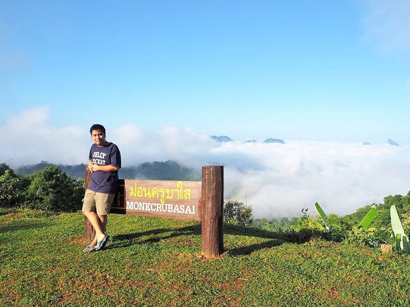
There’s 3 amazing viewpoints to see the sea of mist in one place, and the best part? You can just drive to all of them – no hiking required.
Once you get the National Park Headquarters, all three viewpoints are just 7 to 12km away – and all three places are equally beautiful, making it so hard to visit only one. Make it to all three if you can.
#1: Mon Kru Ba Sai viewpoint is where you can view both sunrise and sunset.
#2: Mon Pun Suda viewpoint is named after the renowned Thai photographer who discovered this spot – you can ensure that it’s photo-worthy.
#3: Mon Kew Lom viewpoint is where you can camp down and view the mist at sunrise.
Lastly, you can also visit Mae Ra Meng Waterfall (น้ำตกแม่ระเมิง), a small waterfall nearby within the National Park!
Mae Moei National Park
Address: Highway 1267, Tha Song Yang, Amphoe Tha Song Yang, Chang Wat Tak 63150, Thailand (Coordinates here)
Getting there: Fly from Chiang Mai International Airport to Sukhothai Airport and rent a car. Head northeast toward Route 1195 and take Route 12, Route 1175 and Route 105 to Route 1267 in ตำบล แม่สอง for 4 hours and 33 mins. Turn right onto Route 1267 and your destination will be on the right
Contact: 055-577 409, +66 88 290 7964
Opening hours: Daily 24/7
Best time to visit: From November to March during the cooler climate and with lesser rainfall.
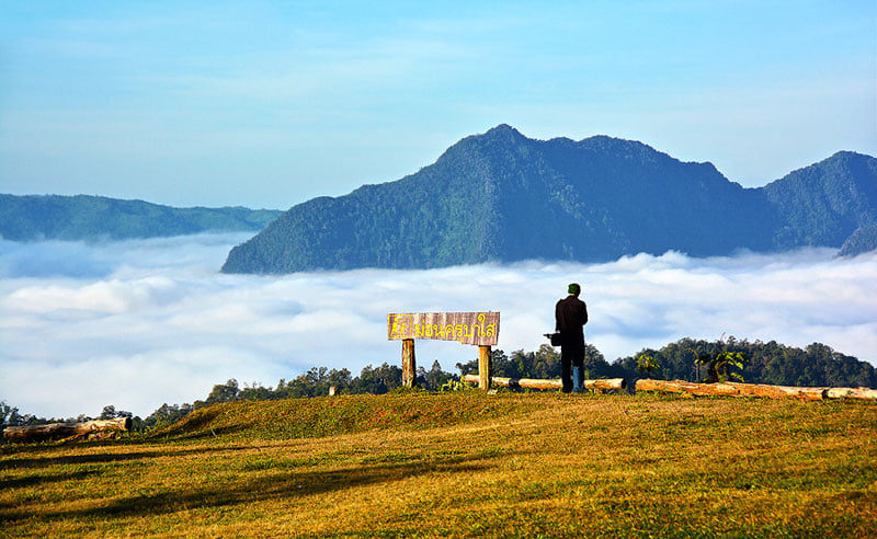
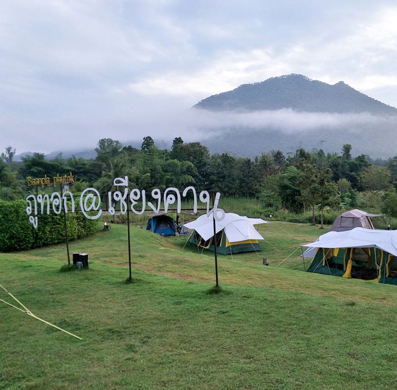
14. See the mist and immerse yourself in the local culture and street food – Phu Thok, Lei (ภูทอก เชียงคาน จังหวัดเลย): Northeastern Region
Time seems to slow down when you here at Chiang Khan.
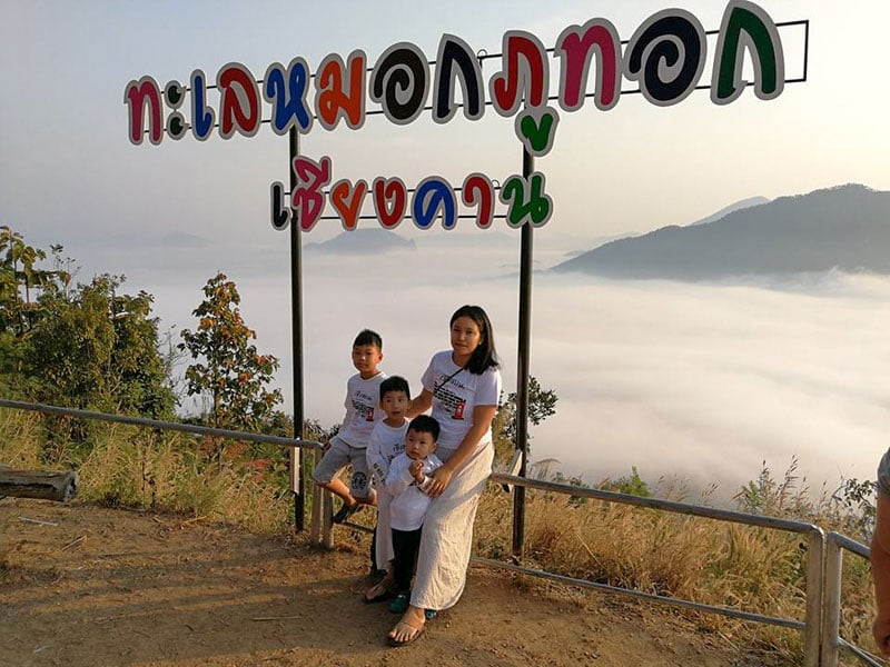
This charming village situated along Mae Khong River in Lei Province – is where you can roam the old town streets, eating local food and making food offerings to the monks.
Phu Thok is a hill, just 8km from Chiang Khan Village. You can hire a local taxi to take you to the foot of the hill, and take Tuk Tuk – how fun! – for a 10 minute ride up to the viewpoint.
Instead of the sea of mist, you can call it an ocean of Mist because it covers a vast area, almost 360º all around the viewpoint.
When you’re done, you can linger around and try local breakfast from street food vendors at the bottom of the hill – or take the taxi back just in time to make food offerings to the monks on the streets of Chiang Khan.
Phu Thok, Lei (ภูทอก เชียงคาน จังหวัดเลย)
Address: Chiang Khan, Chiang Khan District, Loei 42110, Thailand (Coordinates here)
Getting there: Fly to Udon Thani Airport and rent a car. Drive from Route 210, นภ.3012 and Route 2249 to ตำบล นาซ่าว for close to 3 hours and take ถนน องค์การบริหารส่วนจังหวัด เลย เชียงคาน-โพน to your destination in ตำบล เชียงคาน.
Contact: +668 7493 0355
Opening hours: Daily from 5am to 6pm
Entrance fee: Free! USD $0.75/25 Baht for Tuk Tuk to the viewpoint
Best time to visit: You can visit Chiang Khan Village all year round, but the best time to see the mist is in January.
Website 15. Ride a farmer’s tractor to see the mist over Mae Khong river – Phu Huai E San, Nong Kai (ภูห้วยอีสัน จังหวัดหนองคาย): Northeastern Region
Because the region doesn’t have high mountain ranges, people wouldn’t think there would be a spot to see the mist/clouds in the area.
A hidden gem in Nong Kai Province, Phu Huai San gives a very unique and unforgettable sight of the cloudy mist rising above Mae Khong River.
Since the hill is not high, you can feel the mist rolling in from the river toward you. It’s so close that you can feel the cool mist touching your face.
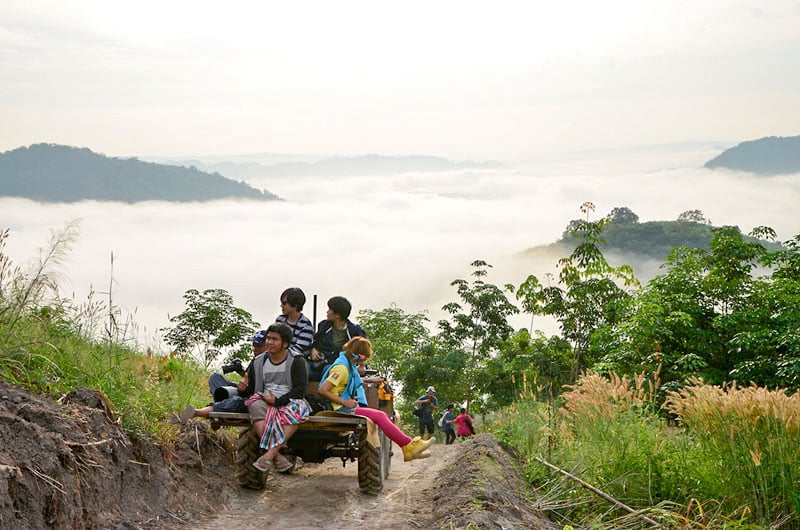
To get up to the viewpoint at Phu Huai San, you must hire a local utility tractor – called ‘E-Taak’. Part of the road, close to the top of the hill, is a rough and narrow dirt road. Hold on tight when you’re travelling up this road! It’s very bouncy but we can assure you, it’s a very fun 20 minute ride.
You can also camp on the banks of Mae Khong River or take a river cruise.
Best time to visit is December to January when it gets very cold.
Phu Huai E San, Nong Kai (ภูห้วยอีสัน จังหวัดหนองคาย)
Address: ตำบล ท่าม่วง จ ว, Tambon Ban Muang, Amphoe Sangkhom, Chang Wat Nong Khai 43160, Thailand (Coordinates here)
Getting there: Fly to Udon Thani Airport and rent a car. Drive to Route 2423 and
Follow Mittraphap Road/ถนนมิตรภาพ to Route 211 in ตำบล บ้านม่วง. Follow the road till you come across เลิฟภูห้วยอีสัน, then take a left.
Opening hours: Daily from 8am to 7pm
Entrance fee: Tractor shuttle to get to the viewpoint is USD $1.90 / 60 Baht for a round trip/person.
Best time to visit: During December to January when it gets very cold!
16. Just a few hours from Bangkok where you can see the mist all year long – Khao Phanoen Thung, Phetchaburi (พะเนินทุ่ง จังหวัดเพชรบุรี): Central Region
This is a mountain high up at 1207m above sea level at Kaeng Krachan National Park in Phetchaburi. Khao Panoen Thung is one of the nearest spots from Bangkok to see the sea of mist/clouds.
The very unique thing about Khao Phanoen Thung is that you can see the mist all year long, even in summer because the reservoir below gives out moisture all year long.

And you can see it not just during sunrise, but also in the evening during sunset if it rains in the afternoon.
There are 2 best spots that you can view the mist from. At the 30km marker and 36km marker. You can camp at the viewpoint or camp at the nearby Ban Krang village, where you also can observe wild birds and butterflies.
PS: Mobile reception is limited to one telco only, AIS. Do be sure to get an AIS local simcard if you plan to travel here.
Khao Phanoen Thung, Phetchaburi (พะเนินทุ่ง จังหวัดเพชรบุรี)
Address: Kaeng Krachan District, Phetchaburi 76170 (Coordinates here)
Getting there: Fly to Hua Hin Airport and rent a car. The drive will take approximately 1 hour. Start on Route 4 and Route 1010 to โยธาธิการ in ตำบล ห้วยทรายเหนือ for 20 mins then turn right onto โยธาธิการ. Follow Route 6005 and Route 4006 to Route 3432 in ตำบล ห้วยแม่เพรียง. Turn left onto Route 3432 and your destination will be 4 mins away.
Contact: 0 3245 9293
Opening hours: Daily 24/7 (However, do be sure to check with the national park office in advance as they have a restricted schedule allowing vehicles to go up or down one direction at a time due to the extremely narrow and steep uphill 30km road to reach the viewpoint. A 4WD vehicle is highly recommended.)
Entrance fee: Entrance Fee to Kaeng Krachan National Park is USD $0.57/20 Baht for adults. USD $0.27/10 Baht for children. Fee per vehicle varies from USD $0.90 / 30 Baht.
Best time to visit: From November to February when it is cooler. (The National Park closes during rainy season from September to October, and some part of the park are closed from August to October.)
Website 17. 5 Amazing sights in one spot – Khao Kai Nui, Phang Nga(เขาไข่นุ้ย จังหวัดพังงา): Southern Region
Nowhere else in Thailand will you get to experience sunrise, sunset, sea, mountain, and mist in one spot.
Only at Khao Kai Nui in Phang Nga, the hidden gem among the rubber tree plantation just opened to travellers.
One of few spots in the southern province where you can see the mist – at a small hill only 200m above sea level, you will get a view of the low rise mist against Andaman Sea in the horizon. And it is absolutely breathtaking.
You’ll need a 4WD vehicle to reach the viewpoint. And if you want to stay overnight, you can camp at the viewpoint among the rubber trees, or reserve a homestay on the hill.
Another good part of planning a trip here? Besides the mist, there are plenty of beaches nearby to add to your visit!
Khao Kai Nui, Phang Nga(เขาไข่นุ้ย จังหวัดพังงา)
Address: Thung Maphrao, Thai Mueang District, Phang-nga 82120, Thailand (Coordinates here)
Getting there: Fly to Phuket Airport and rent a car. Take your car onto ซอย เทพกระษัตรี to Route 4031 in ตำบล ไม้ขาว before driving onto Route 402 and Route 4 to ตำบล ทุ่งมะพร้าว for approximately an hour. When you see a grocery store (ร้านเอกกิ๊ฟช้อป) on your left, turn left and follow the road. Your destination will be 15 mins away.
Contact: +66 81 083 1609
Opening hours: Daily 24/7
Entrance fee: Free!
Best time to visit: You can visit all year round but best from October to February!
Website There you have it. We’ve revealed the best places to see this magical phenomenon all over Thailand.
Pick one (or two) that suits your time, convenience and budget… and let’s GO! One more thing, don’t forget to pack your warm jacket because it might be cold… 😛
Travel Writer

 简体中文 (Chinese)
 Bahasa Indonesia